

Developers & Architects
Turning Complex Sites Into Buildable Projects
Whether you’re breaking ground on an urban infill parcel, redeveloping a former industrial site, or advancing a public improvement project, no two sites are the same. DGT brings more than 125 years of regional knowledge, in-house technology, and full-service expertise in surveying, subsurface utility mapping, and civil engineering to help you move from uncertainty to a plan you can build on.
Where Regional Knowledge Meets Modern Technology
Development in New England presents challenges that are uncommon in much of the country. Existing utilities, aging infrastructure, fragmented property records, complex permitting requirements, and decades—or centuries—of previous development mean that few sites are truly straightforward. Success depends on understanding what’s above ground, below ground, and within the regulatory framework before construction begins.
DGT has worked alongside developers, architects, municipalities, and public agencies on projects across this landscape for decades. Our work often begins with a boundary or existing conditions survey, then expands as project needs evolve to include subsurface investigation, engineering, and permitting, and carries through construction layout, as-builts, and final close-out.

Surveying
High-resolution survey data establishes the baseline for informed engineering and design decisions.
- Existing Conditions Surveys
- Topographic Mapping
- Flood Zone Surveys
- As-Built Surveys
- Construction Layout
- Deformation Monitoring Surveys
- Earthwork Volume Surveys
- 3D Laser Scanning (Ground-Based LiDAR)
- Site Documentation 2D CAD Drawings
- Deformation Monitoring
- Construction Layout
SUE/SUM
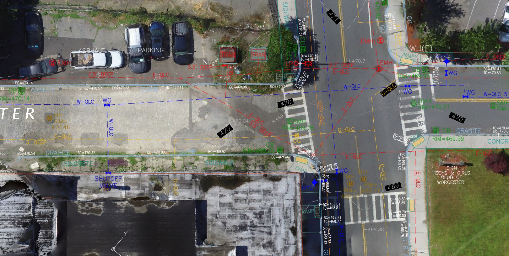
Complex projects demand verified insight below the surface. Our utility mapping services align with CI/ASCE 38-22 standards, helping reduce uncertainty in underground construction and prevent costly utility conflicts.
- Digital Utility Atlas
- Compilation & Analysis of Subsurface Utility Records
- Remote Sensing Technologies for Subsurface Investigation
- Mobile Mapping Ground-Penetrating Radar (GPR) Surveys
- Electro-Magnetic Line Detection & Tracing
- Utility Mapping in BIM/Revit & 2D/3D CAD
- GIS Integration

Engineering
DGT’s civil engineering team guides projects from initial site assessment and design through permitting and inspection, bringing the technical depth and regulatory know-how to move projects forward with confidence.
- Site Plan Review, Special Permit & ZBA Permitting
- Support for MESA & MEPA Filings
- Stormwater Management Analysis & Design
- Watershed/Hydrologic Stormwater & Flood Modeling
- Hydraulic Analysis & Drainage System Design
- Sewer Connection Plans
- Water Connection Plans
- Site Utilities Layout & Design (Water, Sewer, Drain)
- Vehicular & Pedestrian Pavement Layout & Design
- Erosion & Sediment Control Layout & Design
- Construction Specifications
- Collaboration with Project Design Team Consultants
- Storm Water Pollution Prevention Plan (SWPPP) Filings with EPA
- Curb Cut & Driveway Permits
- Sewage Disposal System Design
- Peer Review, Professional Review & Consulting
- Expert Witness Review & Testimony

Construction Support
Every decision on a construction site has a ripple effect. Our team has the field expertise, surveying detail, and quality control to keep projects accurate, coordinated, and on track from start to finish.
- As-Built Surveys
- Building and Site Work Control
- Construction Layout
- Deformation Monitoring Surveys
- Earthwork Volume Surveys
- Floor Flatness Surveys
- High-Rise Control
- Settlement Levels
What Working With DGT Delivers
Verified Boundary, Conditions, & Subsurface Documentation
A project designed around incomplete site information will eventually meet reality in the field. DGT delivers verified boundary documentation, existing conditions surveys, and subsurface records that give project teams an accurate, complete picture of the site during planning—before the decisions you can’t take back.
Access to 140+ Years of Regional Site History
DGT’s archive of plans, surveys, and records from its legacy firms spans more than 140 years and is one of the most extensive in New England. On sites with long or complicated histories, DGT brings historical context that current records don’t contain, giving project teams a more complete picture of the ground they’re working on.
Survey Support That Meets Attorney, Lender, and Regulator Standards
Development projects touch legal teams, lenders, title companies, and regulators, each with their own documentation requirements. DGT has worked alongside these groups across hundreds of projects, producing ALTA/NSPS Land Title Surveys, boundary documentation, and site records that meet those standards.
Continuity From Site Planning to Final Certification
Development projects typically cycle through multiple firms as they move from acquisition to close-out. Every handoff means re-explaining the site and trusting that nothing important gets lost. DGT’s range across surveying, subsurface mapping, engineering, and construction support means the same institutional knowledge travels with the project from start to finish.
Advanced Technology That Minimizes Risk and Disruption
DGT is one of the only nationwide geospatial firms that owns and operates advanced remote sensing technologies, enabling our team to capture large project areas daily.
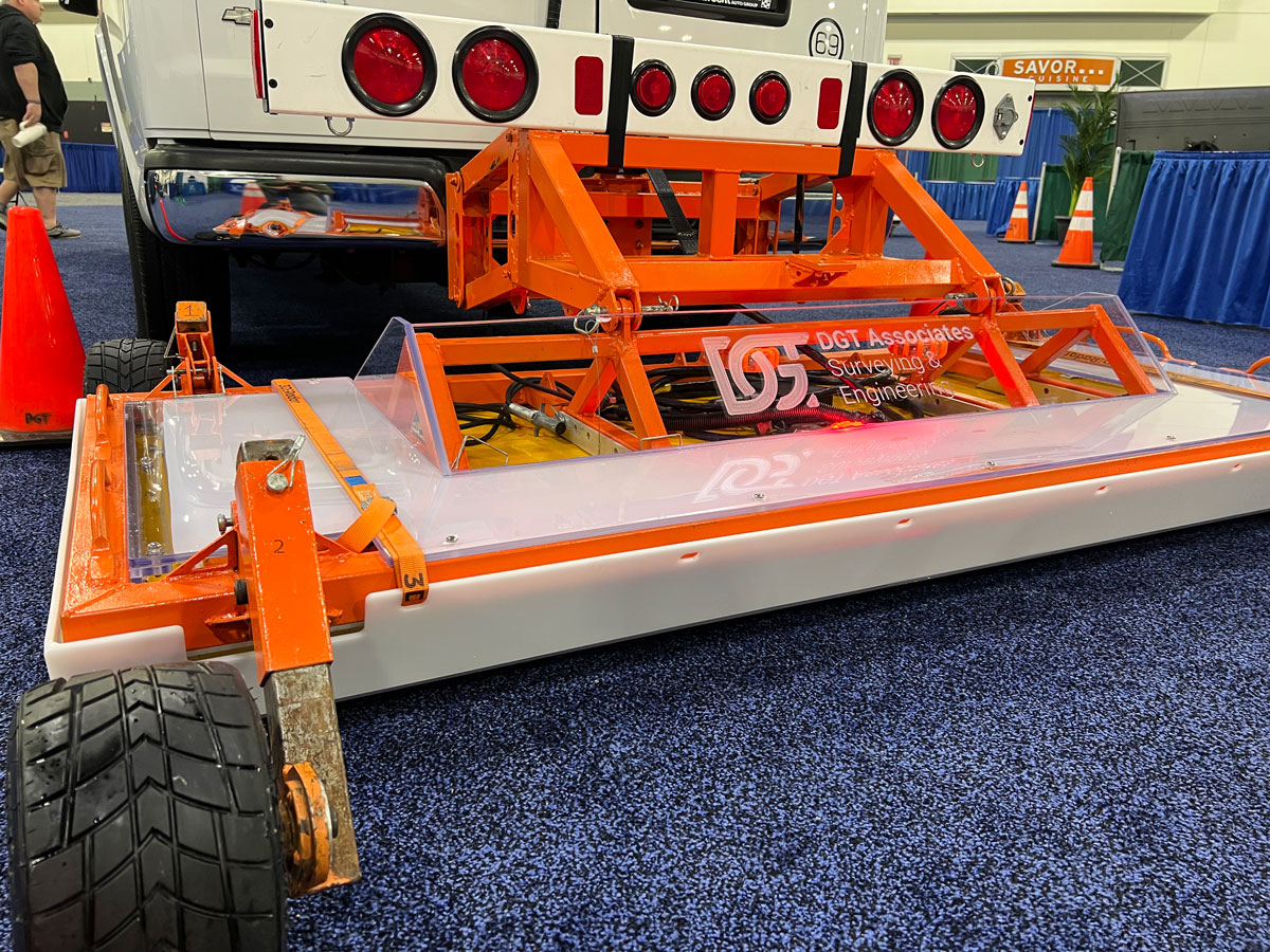
Remote Sensing Technology and Mobile Mapping
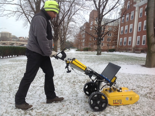
Minimizes disruption to pedestrian and vehicular traffic and eliminates the need for police detailing while extracting high-definition images of the underground. Our technology includes pushcart GPR systems, mobile mapping GPR, EMI (traditional pipe locators), and more.
Radar Tomography
Wide array, multifrequency, high-speed data acquisition technology that provides an extra level of care and detail.
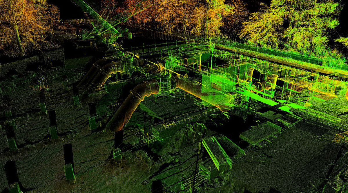
3D Imaging and LiDAR Systems
3D scanners capture a 360-degree picture of the above-ground environment to provide context for underground mapping and allow modeling of existing facilities.
Aerial Imagery
DGT combines imagery with our utility mapping to add perspective and ‘ease of use’ for our clients.
Project Spotlight
A Century of Survey Work on Boston’s Most Historic Waterfront Block
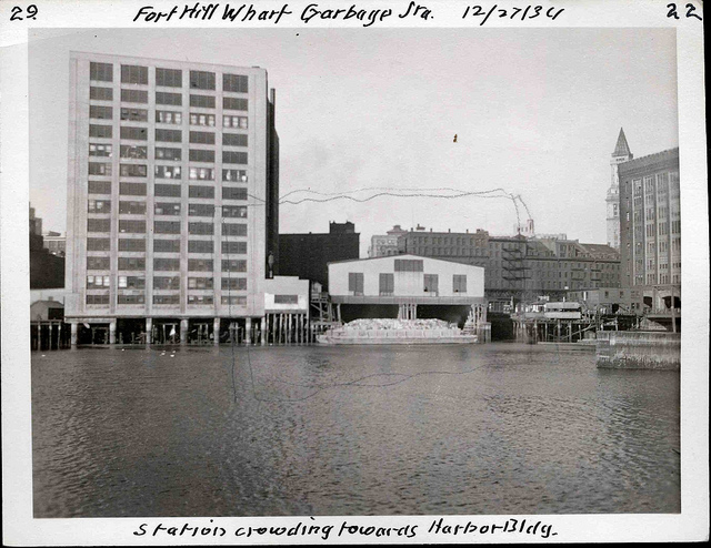
The stretch of Atlantic Avenue along Fort Point Channel has been continuously transformed for centuries. Today, it is home to three landmark properties, and for more than 100 years, DGT and its legacy firms have helped document, survey, and support the evolution of this historic waterfront block.
Atlantic Wharf (520-540 Atlantic Avenue)
DGT’s work on Atlantic Wharf began with the foundation phase. Tasked with building a slurry wall to support the site’s top-down construction and excavating a below-grade garage while the 32-story steel frame rose above it, East Coast Slurry Co., a longtime client, tapped DGT to interpret foundation drawings and provide on-the-ground layout for the slurry wall system. That work led to a follow-on contract with Hub Foundation Company for layout of the project’s Load Bearing Element shafts.
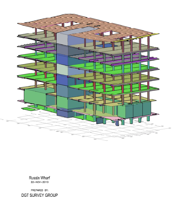
Being on site early surfaced a separate problem: aligning the new high-rise with the building’s existing 19th-century warehouse facades called for more precision than the existing drawings could offer, particularly at the floor elevations. Boston Properties’ construction group brought DGT on directly. Working alongside architect CBT, DGT’s 3D survey team scanned the existing structure to build CAD models for the structural design, work that later expanded to interior as-built surveys as design changes came through.
DGT’s role on the project closed out with prime contractor John Moriarty & Associates, another longtime client, handling day-to-day survey control, QA/QC, and ongoing as-builts through the building’s topping off.
InterContinental Hotel and Residences (500 Atlantic Avenue)
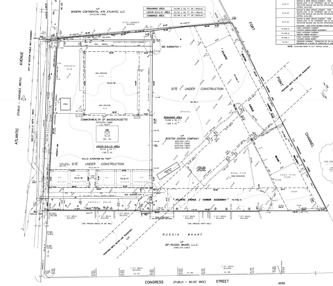
DGT’s history with this site goes back to 1992, when predecessor firm Gunther Engineering was hired by Boston Edison Company (now Eversource) to survey the site of a major electric substation ahead of a significant change in use. That change would eventually give rise to the hotel and condominium complex standing there today, along with a hidden ventilation shaft for the I-93 Tip O’Neill Tunnel and a section of the MBTA Silver Line connecting South Station to Logan Airport.
Gunther brought in DGT to survey the newly built concrete vent shaft using DGT’s recently acquired Cyrax 2500, one of the earliest 3D terrestrial laser scanners in the region at the time. That data helped inform how the vent shaft would ultimately be wrapped into the hotel and residence structure. After DGT acquired Gunther Engineering in 2006, developer Extell Development brought DGT on directly to complete an ALTA/NSPS Land Title Survey for the finished site.
470 Atlantic Avenue (Independence Wharf)
DGT has supported this 14-story commercial building since 2022, engaged by Wise Construction to assist with Nan Fung Life Sciences Real Estate’s repositioning of the property into lab and office space. Starting with subsurface utility investigation and mapping, that work has continued through building control surveys as construction progresses.


Surveying
A. John Lloyd, PLS
As a licensed Professional Land Surveyor in Maine, Massachusetts, Rhode Island, Kentucky, and Tennessee, John has with more than 35 years of industry experience. At DGT, he oversees operations for projects across central and western Massachusetts, with a particular focus on leading 3D scanning initiatives.
John represents the surveying profession nationally as a member of the Board of Directors for the National Society of Professional Surveyors (NSPS). He is also the current Chairman of the Scholarship and Program Committee for the Maine Society of Land Surveyors (MSLS), where he previously served as President from 2005 to 2007.

SUE/SUM
Michael A. Twohig
Led by Michael A. Twohig, Director of Subsurface Utility Mapping and a globally recognized SUM expert, DGT Associates understands the complex impact of underground environments on planning and infrastructure improvement projects.
Michael brings more than 40 years of global experience in professional utility locating and mapping, underground damage prevention, industry safety awareness program, and passion for educating colleagues in the industry to every project he leads.

Engineering and Construction Support
Bert E. Corey, PE
As a licensed Professional Engineer, Soil Evaluator, and Title 5 System Inspector in Massachusetts, Bert brings more than 20 years of experience to his role as Engineering Department Manager at DGT. He oversees civil engineering site planning, roadway design, stormwater management, and sewage system design across commercial, industrial, residential, and municipal projects of all scales.
Bert holds a B.S. in Civil Engineering from UMass Lowell and an M.S. in Environmental Engineering from Worcester Polytechnic Institute.