

You Can’t Modernize What You Can’t See
The U.S. loses an estimated 2.1 trillion gallons of water annually due to failures in our overwhelmingly aging water infrastructure.
Modernizing these systems is no small task and requires accurate, reliable data about the underground built environment. That’s where experienced surveying and SUE/SUM professionals are critical.
Partners in Risk Assessment
DGT partners with public and private sector clients to deliver surveying and Subsurface Utility Engineering and Mapping (SUE/SUM) services to proactively correct inaccuracies in existing facility records, inform system design, improve implementation efficiency, and ensure crew and community safety.
Our capabilities provide quality data for risk assessment across essential aspects of water transmission and distribution—from identifying leaks, voids, and sinkhole conditions to supporting emergency excavation responses.

Surveying
High-resolution survey data establishes the baseline for informed engineering and design decisions.
- Existing Conditions Surveys
- Topographic Mapping
- Right-of-Way Mapping
- Flood Zone Surveys
- As-Built Surveys
- Construction Layout
- Deformation Monitoring Surveys
- Earthwork Volume Surveys
- 3D Laser Scanning (Ground-Based LiDAR)
- Site Documentation 2D CAD Drawings

SUE/SUM
Complex energy projects demand verified insight below the surface. Our utility engineering and mapping services are aligned with CI/ASCE 38-22 standards, helping to reduce uncertainty for underground construction and prevent costly utility conflicts.
- Subsurface Utility Engineering & Mapping to CI/ASCE 38-22 Standard
- Compilation & Analysis of Subsurface Utility Records
- Remote Sensing Technologies for Subsurface Investigation
- Ground-Penetrating Radar (GPR) Surveys
- Electro-Magnetic Line Detection & Tracing
- Utility Mapping in BIM/Revit & 2D/3D CAD
- GIS Integration
Built for the Challenges of Modern Water Infrastructure
Leak Detection
Undetected leaks lead to voids, sinkholes, and costly surface damage.
Emergency Excavation Response
Water line failures demand fast action, but underground unknowns put crews at risk.
Utility Corridor Surveys
Congested underground environments leave little room for error during replacement work.
Flood Risk Mitigation
Aging drainage systems weren’t built for today’s storm intensity.
Anomaly Detection
Hidden obstacles like buried rail and abandoned utilities derail projects mid-construction.
Replacement Project Planning
Incomplete records make it difficult to plan water line upgrades with confidence.
Regulatory and Design Compliance
Project teams need verified subsurface data to meet specs and protect against liability.
Underground Damage Prevention
Third-party utility strikes remain a leading cause of damage to critical underground infrastructure, and even small construction projects can pose a serious threat to municipal networks.
Understanding CI/ASCE 38-22 Quality Levels
DGT’s utility mapping services span all four CI/ASCE 38-22 Quality Levels to match project type and budget.
CI/ASCE 38-22 Quality Level D
Research and compilation of proprietary and public utility records to understand site history and existing documentation. Ideal for early-stage planning with lower financial investment.
CI/ASCE 38-22 Quality Level C
Surface-visible utility features are surveyed and correlated with existing records to improve mapping accuracy.
CI/ASCE 38-22 Quality Level B
Buried utilities are detected and mapped using appropriate geophysical technologies. Data is collected by mapping professionals and delivered in CAD or GIS platforms for design integration.
CI/ASCE 38-22 Quality Level A
The highest level of certainty. Using data from vacuum excavation, DGT captures and documents the results to confirm horizontal and vertical utility location, along with pipe size, depth, material, and condition. This level significantly reduces construction risk and utility strikes.
Advanced Technology That Minimizes Risk and Disruption
DGT is one of the only nationwide geospatial firms that owns and operates advanced remote sensing technologies, enabling our team to capture large project areas daily.
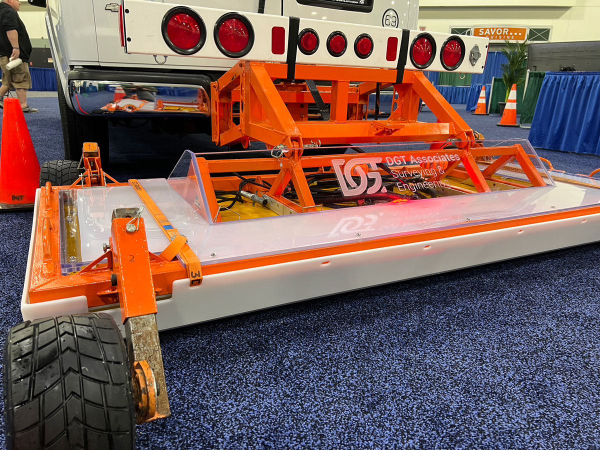
Remote Sensing Technology and Mobile Mapping
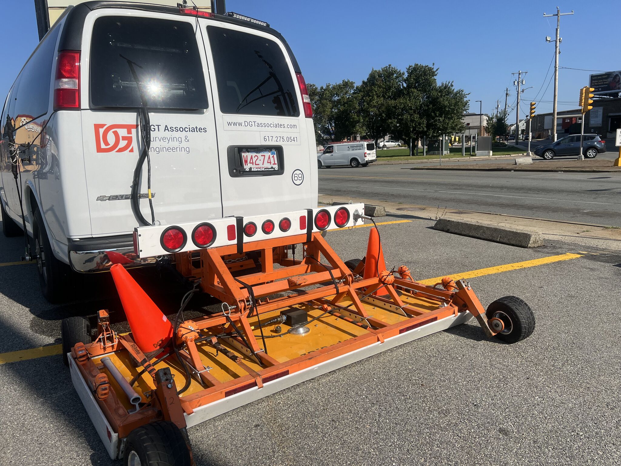
Minimizes disruption to pedestrian and vehicular traffic and eliminates the need for police detailing while extracting high-definition images of the underground. Our technology includes pushcart GPR systems, mobile mapping GPR, EMI (traditional pipe locators), and more.
Radar Tomography
Wide array, multifrequency, high-speed data acquisition technology that provides an extra level of care and detail.

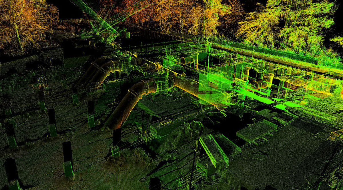
3D Imaging and LiDAR Systems
3D scanners capture a 360-degree picture of the above-ground environment to provide context for underground mapping and allow modeling of existing facilities.
Aerial Imagery
DGT combines imagery with our utility mapping to add perspective and ‘ease of use’ for our clients.
Project Spotlight
Combatting Urban Flooding Through Subsurface Insight
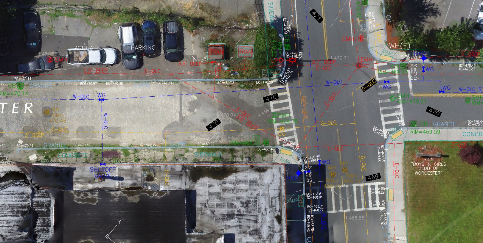
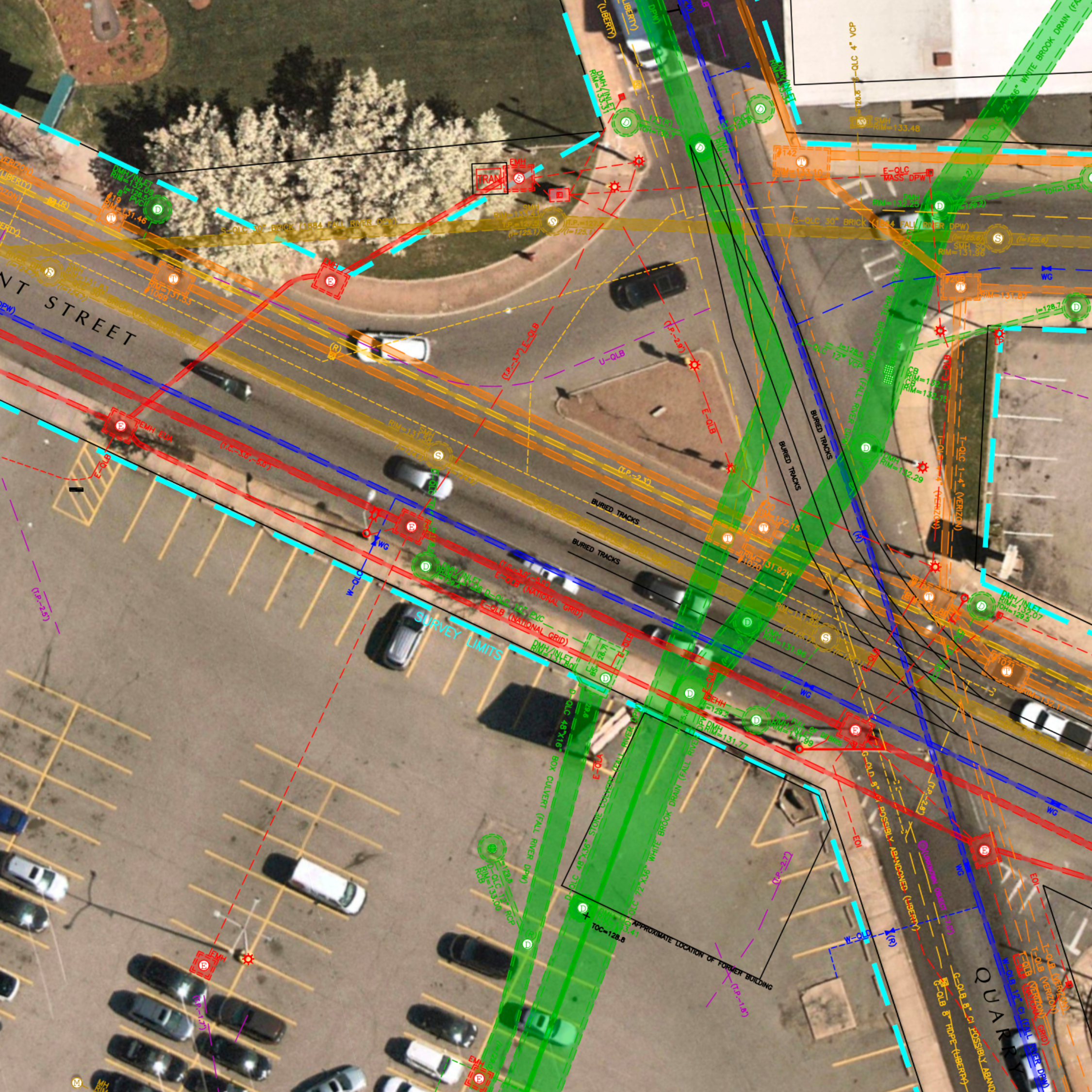
When severe flooding began taking a growing toll on the historic industrial Stafford Square neighborhood in Fall River, MA, the DGT team was called in to help address the root cause.
To support the replacement of outdated drainage infrastructure, our team deployed total stations, mobile mapping, and ground-penetrating radar (GPR) to deliver detailed surveying and subsurface investigation services. The data we gathered allowed us to produce a precise topographic utility map—complete with datum and AutoCAD deliverables—that revealed a complex underground environment, including abandoned utilities and historic streetcar tracks.
These critical insights gave designers and engineers a full understanding of both surface and subsurface conditions, empowering them to develop more strategic, effective project plans and avoid the costly surprises that so often derail infrastructure work.
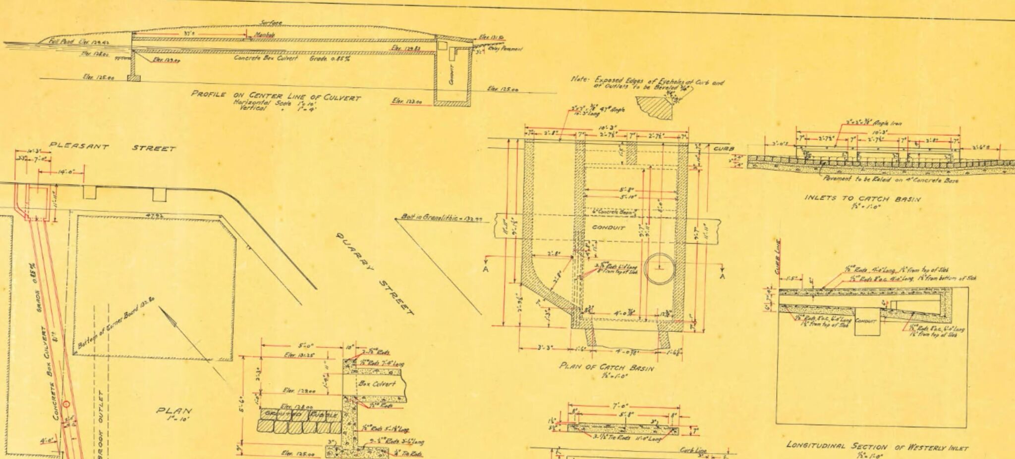


Surveying
A. John Lloyd, PLS
As a licensed Professional Land Surveyor in Maine, Massachusetts, Rhode Island, Kentucky, and Tennessee, John has with more than 35 years of industry experience. At DGT, he oversees operations for projects across central and western Massachusetts, with a particular focus on leading 3D scanning initiatives.
John represents the surveying profession nationally as a member of the Board of Directors for the National Society of Professional Surveyors (NSPS). He is also the current Chairman of the Scholarship and Program Committee for the Maine Society of Land Surveyors (MSLS), where he previously served as President from 2005 to 2007.

SUE/SUM
Michael A. Twohig
Lead by Michael A. Twohig, Director of Subsurface Utility Mapping and globally recognized SUM expert, DGT Associates understands the complex impact of underground environments on campus master planning and improvement projects.
Michael brings more than 40 years of global experience in professional utility locating and mapping, underground damage prevention, industry safety awareness program, and passion for educating colleagues in the industry to every project he leads.