Subsurface Utility Mapping & Engineering (SUM/SUE)
Creating a higher level of accuracy of the underground environment

Building the Case for SUE/SUM
A decisive factor in a project’s success depends on accurately knowing the intricacies of the subsurface environment. When combined with historical underground utility records in the design phase of a project, Subsurface Utility Mapping (SUM) delivers insights your team can rely on.
By utilizing DGT’s mapping expertise and 811’s markouts in unison, underground damage prevention programs are successful, construction risks are managed, and project owners gain a clear understanding of what lies underground before breaking ground.
Providing SUM services across the U.S., our highly skilled, professional mapping specialists help our strategic clients by creating detailed CAD and Subsurface Information Modeling (SIM) maps of underground facilities at project sites.
The Recipe for Success
At DGT, we undertake strategic projects for clients looking to build a map depicting the underground infrastructure. To aid in the process, you’ll work directly with a diverse team of leaders who have experience across industries and countries and believe in utilizing both traditional utility locating devices and advanced technology.

01
Engage Industry Experts
Whether you’re looking to find a high-skilled professional team to map the underground for a small project or beginning to build a complete Campus Digital Atlas of the underground, DGT has the expertise to make your project a success. We assist clients with a range of project budgets in reaching their goals of an underground map for digital twins.

02
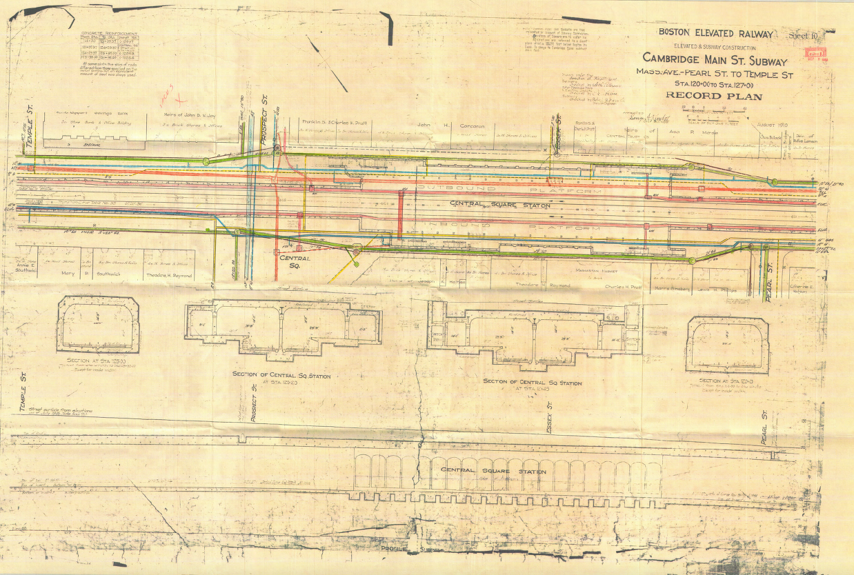
Record Collection
DGT’s mapping professionals utilize proprietary and public utility records to understand the evolution of your site and the history behind it. While reviewing legacy data and digital archives, we amalgamate all records and generate a single source of truth. This includes ASCE 38-22 Quality Level C & D surveying data—a lower financial investment. To gather a higher level of detail, we perform ASCE 38-22 Quality Level A & B surveying. If design and groundbreaking of a site are taking place, we recommend level A & B standards which allow for a safer, more accurate project site.

03
Underground Utility Mapping
No two projects are the same and every project requires careful consideration and research. With initial insight into the project, we can develop our project approach, create a scope, and decide on the appropriate application of technology. Additionally, we work alongside your team to define a Standard of Care for underground utility mapping. As a technology-focused firm, we leverage modern technology, such as radar tomography, to meet each project’s needs.

04
Interpret Results
With DGT’s history of excellence in traditional land survey practices, our team can ensure all the above and below-ground data will be positioned accurately. Using a project survey datum, DGT data will be highly accurate and reliable.

05
Deliver Findings
Following survey locating and subsurface investigations on site, the data is downloaded and processed, and the results are imported into CAD or GIS delivery platforms with the appropriate attribution. All DGT subsurface utility mapping projects end with the delivery of color-coded documents in conformance with the American Public Works Association (APWA). Additionally, within a single portal, DGT can integrate utility records and existing utility information to allow clients access to a comprehensive, historic view of their site’s utility information.
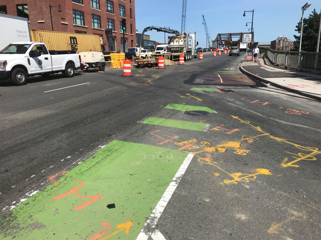
Improve Project Safety
While the 811 One Call and Call Before You Dig programs have matured over the past 50 years, utility marks by contract locators and One Call responders are only a small part of an underground damage prevention program. Mitigating the risk associated with underground facilities begins with a thorough subsurface investigation. With the findings, owners and designers can make informed decisions and avoid utility conflicts and accidental damage. While utility marks on the ground are here to stay, developing a comprehensive digital program to understand the underground workings, including using new visualization tools, is the future.
Facilitate Buildable Designs
Ambiguity in the existing condition survey can lead to errors in design and contraction. Project delays, construction claims, and utility damage are often attributed to incorrect utility information in construction documents. By performing a risk assessment of the underground environment, you can ensure your project site is feasible for development.
Mitigate Risk
By engaging underground asset owners early in the project, and combining data gathered from Subsurface Utility Mapping with historical records, we’re able to mitigate the risk of striking undocumented utilities, avoid utility conflicts, improve project execution, and minimize changes and claims.
Avoid Costly Mistakes
Missing, incomplete, or inaccurate maps of the underground environment can lead to huge financial burdens. With contractor claims, revised permitting submissions, project redesign, litigation, settlements, and your reputation on the line, don’t overlook the opportunity to complete a thorough subsurface utility investigation.
Leverage Accurate Records
Utilizing historical records is an important piece of the puzzle, but you shouldn’t rely on records alone. Even with documentation, underground assets could have shifted, or unrecorded and abandoned assets may linger. Updated subsurface mapping can minimize risk and prevent underground damage.
Servicing AEC Professionals & Beyond
Hover over images to see detail
Remote Sensing Technology & Mobile Mapping
Remote Sensing Technology & Mobile Mapping
While the type of remote sensing technology – such as push cart GPR systems and EMI (traditional pipe locators) – will vary by region, complexity of the work, and project budget, the results enable a safer, more efficient project.
Remote Sensing Technology & Mobile Mapping
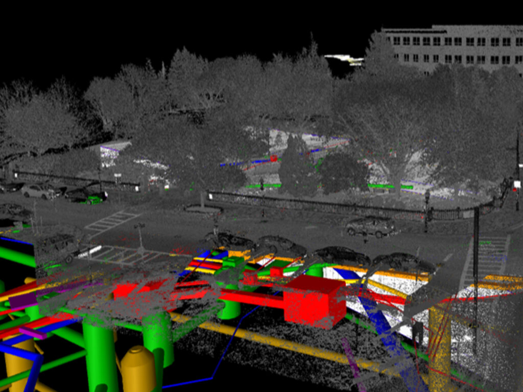
Radar Tomography
Radar Tomography
Radar Tomography
Radar tomography is not new to our industry. However, in earlier years, the systems were not suitable for subsurface utility investigations. The speed, complexity, processing software, and high capital investment in the technology prevented many utility surveyors from utilizing the technology.
In 2021, DGT decided that an in-house system, run by our team of experts, would be more conducive to controlling the quality of our final digital deliverables. Using light from lasers to collect measurements and 3D scanners to capture a 360-degree picture of the above-ground environment, radar tomography has provided great context for underground mapping.
3D Imaging and Lidar Systems
3D Imaging and Lidar Systems
Using light from lasers to collect measurements, 3D scanners capture a 360-degree picture of the above-ground environment, which provides context for underground mapping. This includes 3D scanning and imaging inside vaults, structures, tunnels, areaways, and more.
3D Imaging and Lidar Systems
Drone Imagery
Drone Imagery
Drone Imagery
In surveying, the applications for drones are almost infinite: 3D laser scanning, façade mapping, site monitoring, as-builts, and even underground utility mapping using LiDAR systems. Drone work has become increasingly popular as a cost-effective and work-efficient alternative to traditional aerial photography.
2D and 3D Project Delivery Formats
2D and 3D Project Delivery Formats
One of the greatest challenges for Subsurface Utility Mapping programs is providing functional, easy-to-read final delivery formats for strategic clients. Our delivery formats include complex 3D/SIM models and traditional 2D CAD plans.
2D and 3D Project Delivery Formats
Digital Utility Atlas
Digital Utility Atlas
Digital Utility Atlas
To help campuses and other facilities shift from inconvenient paper records, we offer a digital utility atlas—comprehensive maps of your underground environments converted into a searchable, single-source digital platform that can be shared with decision-makers. A digital utility atlas also aids in succession planning and ensures future generations of facility managers have the information they need to be effective.


Meet the Expert
Michael A. Twohig
Led by Michael A. Twohig, Project Director for Subsurface Mapping and globally recognized Subsurface Utility Mapping expert, the DGT Associates SUM/SUE team understands the complexity of New England’s development and has the experience and expertise to meet its unique challenges.
As the leader of Subsurface Utility Mapping at DGT, Mike brings over nearly four decades of experience in professional utility locating, mapping, underground damage prevention, and industry safety awareness programs.