Columbia Gas Explosion Sheds Light on Industry-Wide Neglect of Subsurface Utility Standards
Columbia Gas Explosion Sheds Light on Industry-Wide Neglect of Subsurface Utility Standards
On Sept. 13, 2018, gas lines in Lawrence, Andover, and North Andover became dangerously over-pressurized, leading to fires and explosions that killed a man sitting in his driveway, destroyed at least five homes, damaged more than 100 structures, and sent at least 21 people to the hospital.
The costly incident was attributed by the National Transportation Safety Board (NTSB) to poor design, planning and management of a construction project including the failure to relocate key sensors and a low-pressure distribution system that did not have proper over-pressure protection. In findings issued less than two weeks after the explosions, the NTSB found that Columbia Gas’s “weak engineering management” was the probable cause of the incident. The report stated, the utility company “did not adequately plan, review, sequence, and oversee the construction project that led to the abandonment of a cast-iron main without first relocating regulator sensing lines to the new polyethylene main.”
In other words, Columbia Gas’ subsurface utility work was substandard and undocumented; a scathing review. “It’s amazing to me that a company that operated this system for more than 100 years could not produce a map, a readily made map…” said one NTSB official.
More than a year after the Columbia Gas explosions, what has the industry learned from this experience? Have we improved practices and procedures so that the likelihood and frequency of such events decrease in probability?
To be substandard, you have to know the standard
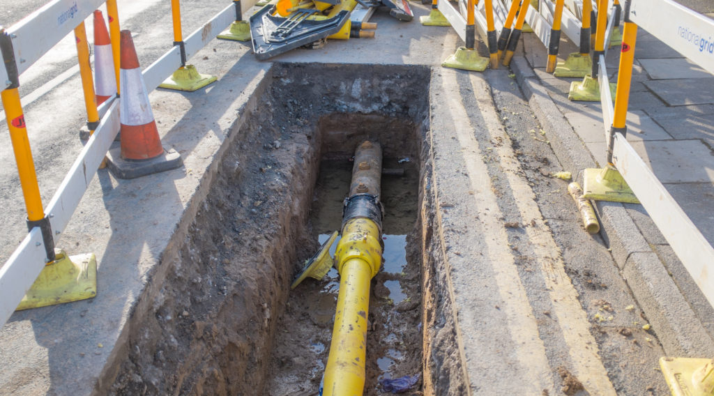
Locating and mapping buried infrastructure is a well-defined discipline for seasoned utility surveyors. The failure to adhere to the fundamentals of the discipline is not only substandard practice, but also hazardous to the public. In the Columbia Gas incident, both poor management and recordkeeping contributed to the domino-effect of problems.
Accidents like this one are bound to happen when asset owners and engineers only engage in subsurface utility mapping (SUM) at their own discretion. As Sen. Ed Markey stated in his Sept. 24 press release, “No pipeline company should ever be allowed to cut corners on safety in order to cut down on costs.”
Decades ago, asset owners valued the in-house survey team within their construction departments. And, engineers frequently valued a reliable site plan prior to final design and construction. Now, profit margins are the big focus for decision-makers, and proper work planning and safety too often take a back seat.
The results of the NTSB’s findings may have been a surprise to the public; unfortunately, for professionals in the industry, it’s all too common.
“When you speak with surveyors around the country, you quickly realize that that poor utility records are a serious problem everywhere, and therefore a national issue,” said John Lloyd, PLS, Regional Office Manager, DGT Worcester. “Most often, surveyors are the professionals that are being asked to map utilities, but much of the time accurate utility records, the base information for our work, simply isn’t there.”
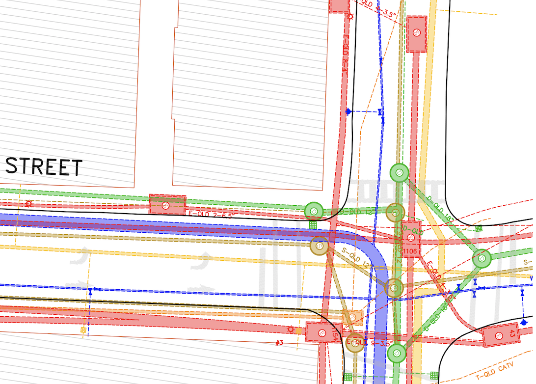
Lloyd serves on the National Society of Professional Surveyors (NSPS) Board of Directors and frequently observes companies lacking the accurate subsurface utility maps necessary to perform safe utility work. That accuracy is largely driven by the American Society of Civil Engineers (ASCE) 38-02 Standard Guideline. Within ASCE 38-02, there are Levels A through D that determine the “quality and reliability of utility information,” with Level D including “information derived from existing records or oral recollections,” and Level A providing precise horizontal and vertical location of utilities from exposure and direct observation.
It starts with us, the surveyors
It is critical that utility companies, construction companies, surveyors and mapping professionals, and developers be aware of the 38-02 standards and understand how their existing and future subsurface maps match up to the quality levels.
“If you are Columbia Gas receiving your utility map, you need to know both the source of the utility data presented on the map, as well as the quality of that source,” said Lloyd. “But, too often, companies in that situation do not request, or receive, that level of important information.”
Beyond the rare explosion, there are many other ramifications of the general lack of awareness of ASCE 38-02 standards. If owners and asset managers lack an understanding of how plans and maps stack up against ASCE 38-02, anyone that uses that information down the line – private landowners, private companies, developers, or public agencies – will be flying blind.
It is tempting to point fingers or isolate blame. In truth, the responsibility rests on all those in the industry—from asset owners to regulators to surveyors, and many others.
“As surveyors mapping utilities, ASCE 38-02 guidelines are a key component of our profession. I’ll walk into a meeting with other surveyors and ask which ASCE 38-02 Standards they most often work with, and too many of them don’t even know what I’m talking about,” said Lloyd. “If surveyors don’t fully understand these standards, how do we expect others to request and utilize them? When it comes to utility mapping, we all need to be speaking the same language.”
Despite a lag, the industry is catching on to the importance of these guidelines. The issues of poor management and subsurface utility mapping are even coming into the public eye. Several of the news articles surrounding the Columbia Gas explosion zeroed in on the faulty mapping issue.
“Use of these utility standards is becoming more common in the past few years. The feedback we have seen from our clients, especially utility companies, is tremendously positive. They now understand the benefit in receiving more than just a line on a piece of paper.” said Lloyd. “Some clients may still need to call and ask me to explain the differences between the QL-A and QL-D lines on my plan, but that is how we move forward. Nationally, improved utility mapping benefits everyone, and surveyors must take a leadership role in not only implementing these standards, but in educating our clients and the public in their value.”