

Tech-Savvy Isn’t the Same as Licensed: Why Credentials Matter More Than Equipment in 3D Scanning
Tech-Savvy Isn’t the Same as Licensed: Why Credentials Matter More Than Equipment in 3D Scanning
When clients hire 3D scanning services, they’re not just buying a scan. They’re buying the data that design decisions, material orders, and construction plans are all built on.
The value of 3D scanning lies in its millimeter-level accuracy. But that value only holds if the professional collecting and interpreting the data understands what the data will be used for, recognizes when something looks off, and knows when to re-collect.
That’s harder to judge than it used to be. Scanning equipment is more accessible than ever, which makes it difficult to separate practitioners who know how to operate a scanner from those who know how to analyze a site, apply the correct approach, and evaluate what comes back. Beyond technical fluency, the best 3D scanning professionals understand what the data needs to do once it leaves the site, and they’re legally accountable for what gets delivered. That combination of skill and accountability is what separates a true professional from someone who’s just good with the gear.
Not Just a Pretty Point Cloud
Bad scan data isn’t always obvious. To the untrained eye, a flawed point cloud and a survey-grade one look nearly identical on a screen: dense, complete, visually impressive. The errors surface only when someone tries to build from the data. In low-stakes applications, that’s an inconvenience. In high-stakes ones, it can be catastrophic.
If scan data misrepresents the geometry of an existing structure, components get fabricated to dimensions that don’t exist in the field, and the error often doesn’t show up until materials arrive on site. In a BIM workflow, a model built on flawed existing conditions carries that error through every downstream decision, from clash detection to prefabrication to MEP coordination, all of which are only as reliable as the survey they started from. And in forensic documentation, scan data may be introduced as evidence in legal and insurance contexts, where the chain of custody, the methodology, and the credentials of whoever produced it will all be scrutinized.
The Standard of Licensure
In fields where the work carries legal, financial, or public-safety consequences, credentials establish both credibility and accountability. When a structural engineer stamps a drawing, for instance, they’re certifying that the design is safe to build from (and putting their license on the line if it isn’t). Licensure exists because the stakes of getting it wrong are high enough to warrant a verified, enforceable standard. Behind each of those credentials sits specific education, supervised field experience, rigorous examination, and ongoing legal accountability.
However, 3D scanning has no credential of its own. Certain applications are regulated under surveying licensure, but no federal framework spells out which ones, so the rules change from state to state and it’s important to check them wherever you’re operating. And even where licensure applies, it certifies surveying expertise, not 3D scanning knowledge specifically. That patchwork creates real risk for clients trying to evaluate who they’re hiring.
In Massachusetts, when ground-based LiDAR or drone photogrammetry is used to establish property boundaries, prepare topographic surveys, or produce the maps and plans that represent that work, it must be performed under the responsible charge of a state-licensed Professional Land Surveyor (PLS). That stamp carries legal weight, since the PLS is professionally accountable for the accuracy of the data, whether it supports a boundary determination, a permit filing, or a legal proceeding.
Outside those applications, the requirements disappear altogether. General 3D modeling, BIM development, existing conditions documentation, and internal as-built records can legally be performed by anyone with a scanner, with no board reviewing their qualifications and no license on the line if the data fails. In that territory, accountability isn’t guaranteed by anyone’s license; it’s something the client has to vet for on their own.
The Range of 3D Scanning
Whether a project type requires licensure or not, experience and expertise determine whether the job gets done well. And as 3D scanning gets deployed across a wider range of industries and project types, each application brings different site conditions, different standards for accuracy, and different consequences if the data falls short. To ensure a project’s safety and success, professionals must understand not just how to run the scan, but what the data needs to do once it leaves the field.
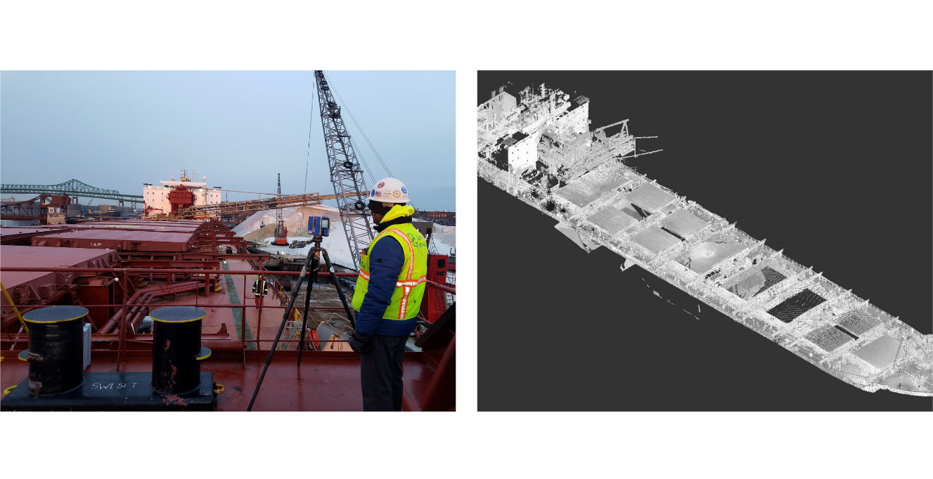
Ship Deck Retrofit: A new cargo handling system had to be laid out on an existing ship deck, with prefabricated components built to fit the conditions exactly as scanned. DGT captured the deck geometry to the precision the fabrication demanded, because a few millimeters of error in the existing conditions model translates directly to a misfit in the field.
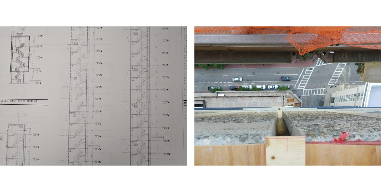
Concrete Facade Replacement: Ahead of a full concrete facade replacement on a 40-story Boston tower, DGT was hired to scan the building’s exterior. Nearly 20 floors were occupied and inaccessible. The team set targets from a rappelling crew at the top of the building and captured the geometry from street level and neighboring rooftops, revealing that the architect’s existing Revit model was off by 2 to 3 inches—a discrepancy that would have been costly to correct once fabrication was underway. Belowground, with the existing foundation staying in place, DGT mapped the utilities around the tower to plan the auger-drilled support piles. Cored-hole survey data and LiDAR captured inside utility chambers came together in a single 3D model of the full above- and belowground environment.
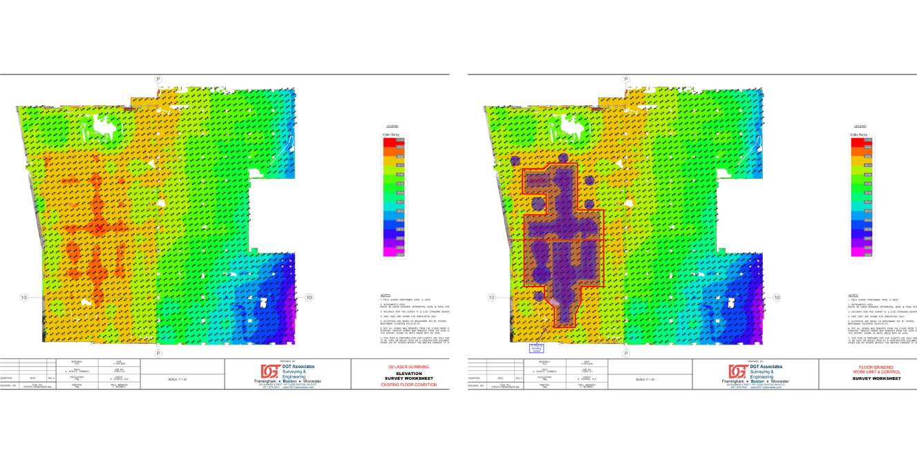
Gymnasium Floor Flatness Survey: A gymnasium floor showing visible irregularities needed to be assessed before remediation work could begin. DGT scanned the full slab and processed the point cloud into heat maps that pinpointed exactly where the floor was running high or low. Because the underlying data was precise enough to trust, the remediation team could determine with confidence which sections needed to be scarified and which needed fill, rather than estimating and risking having to redo the work.
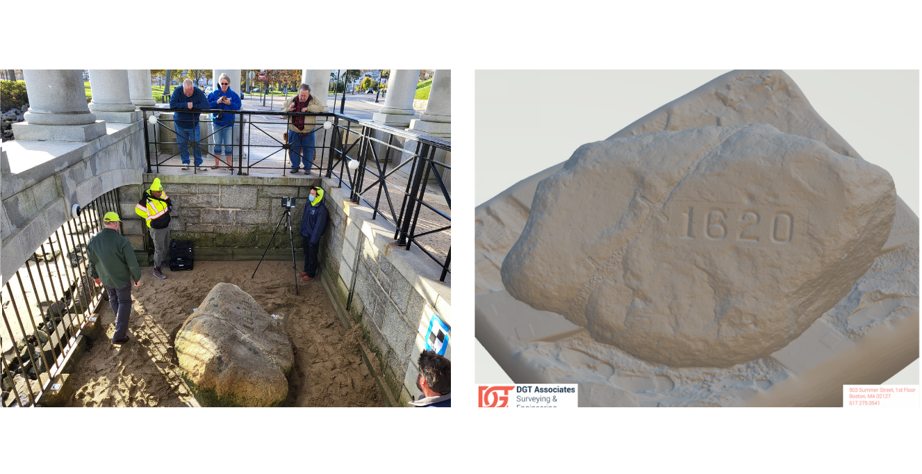
Plymouth Rock Replica: In 2022, DGT partnered with Scrooby Parish Council in Nottinghamshire, England to 3D scan Plymouth Rock in Plymouth, Massachusetts. The scans served as the blueprint for an exact replica cast in bronze, measuring two by five meters and engraved with the names of all 102 Mayflower passengers. The Scrooby Rock now stands as a permanent tribute to the Mayflower voyagers and the Wampanoag people native to the region where they landed. Given the cultural significance of the monument, the accuracy and detail of the scans were essential to producing a replica that truly honored the original.
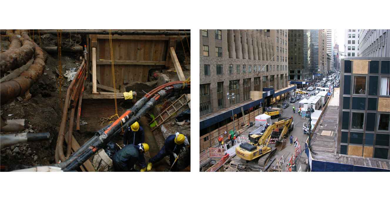
Steam Pipe Explosion Forensic Documentation: In July 2007, an 83-year-old steam main ruptured in Midtown Manhattan during the evening rush hour. The blast killed one person, injured 45, and left a crater roughly 37 feet wide and 20 feet deep. To determine the cause, DGT performed sequential 3D laser scans throughout the week-long excavation, capturing the crater profile, the exposed steam main, and the surrounding intersection in survey-grade detail at each stage. The scans preserved a permanent geometric record of evidence that physically ceased to exist as the investigation proceeded, supporting the official incident report that traced the rupture to a water hammer event in the 1924-era main.
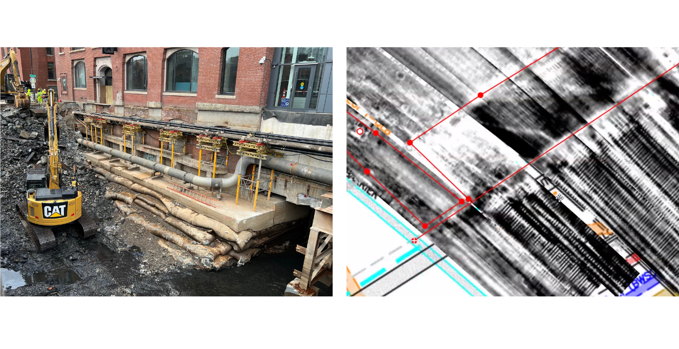
North Washington Street Bridge Replacement: After more than a century of service, the North Washington Street Bridge connecting Boston’s North End to Charlestown was replaced with a modern crossing—and the project called for more than a new span. A new transmission line needed to be integrated into the bridge structure and the adjacent streets, threading fresh energy infrastructure through ground layered with generations of utilities. DGT mapped the above- and belowground environment throughout construction, giving the project team the utility insight needed to tie the new line into one of the city’s oldest and most congested corridors.
Across every one of these projects, the scan itself was only the starting point. A point cloud is raw data until a trained professional interprets it against the project requirements, verifies the accuracy, and takes responsibility for what gets delivered.
Vet the Professional, Not the Equipment List
Owning the equipment isn’t the same as knowing what to do with it, and when the data drives real engineering, legal, or construction decisions, the right questions to ask a scanning firm have little to do with the equipment list on the proposal. Anyone screening 3D scanning firms should ask:
- Who is responsible for this deliverable, and will they put their name on it?
- Is the work performed under licensed professional oversight, even where the law doesn’t require it?
- Have they scanned for this type of application before?
- How will accuracy be verified, and to what specification?
- What happens if the data is wrong?
Together, those questions do what no credential currently can: establish who is accountable for the data and whether the judgment behind the scanner matches the project.
At DGT, the answers are straightforward. The firm’s 3D scanning work is performed under the responsible charge of Professional Land Surveyors with decades of experience across the full range of applications the technology gets put to. What clients build on isn’t the technology itself but the judgment behind how it’s applied and the professional willing to stand behind the results.
Ready to put licensed expertise behind your next scanning project? Let’s talk.