Project Spotlight: Post Office Square — The Future of a District Rooted in Boston’s Past
Project Spotlight: Post Office Square — The Future of a District Rooted in Boston’s Past
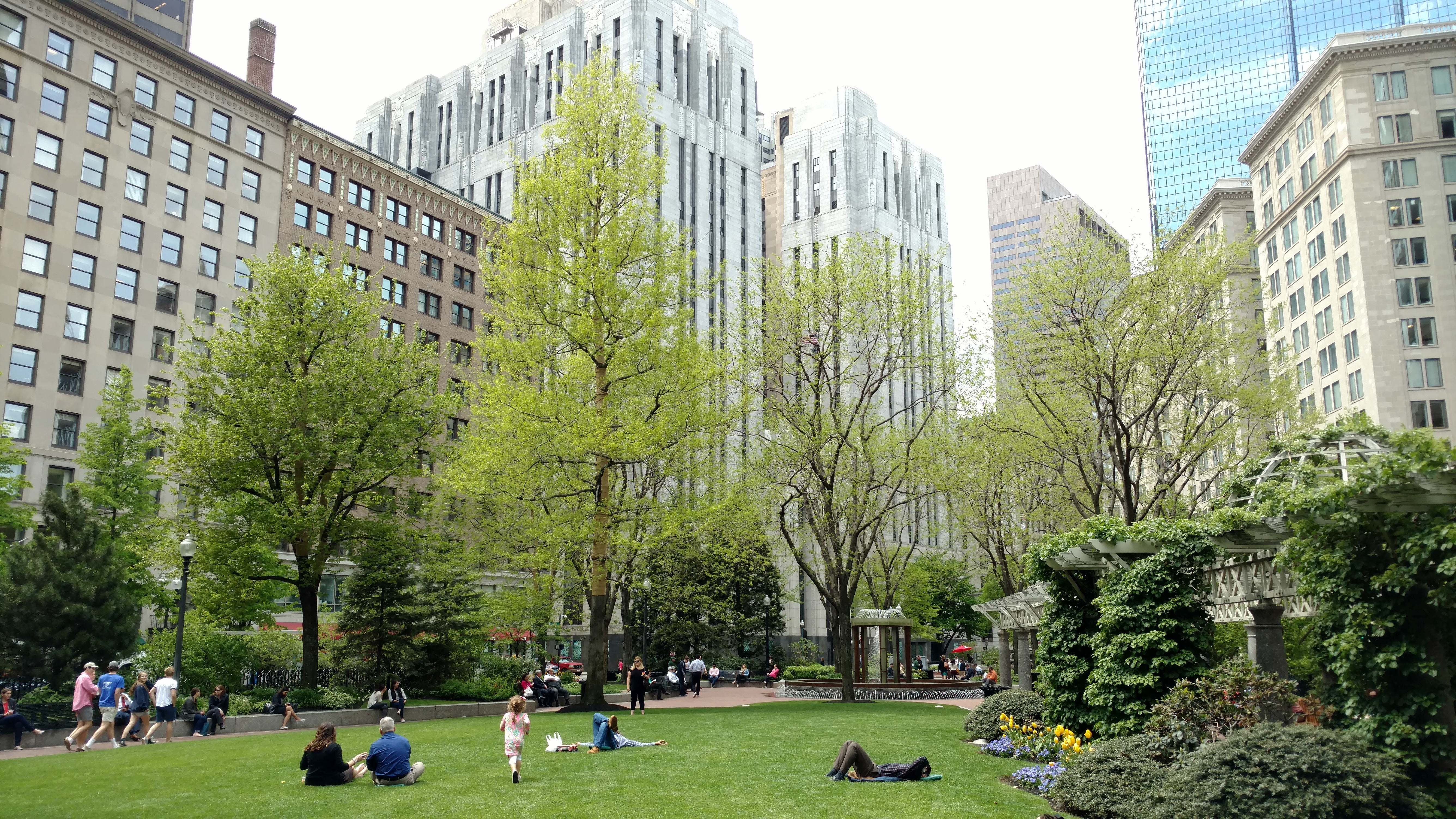
© NewtonCourt / Wikimedia Commons / CC BY-SA 4.0 & GFDL [https://creativecommons.org/licenses/by-sa/4.0/legalcode]
The Financial District is one of the oldest sections of Boston. Since the city began to expand from its humble beginnings, its central business district has grown inwards from the waterfront. Over time, that growth has brought the need for evolving infrastructure to support the burgeoning economic center, which DGT is proud to say we’ve been a part of for decades.
Early Underground Infrastructure
In the early days of development, Boston faced a severe crisis in water quality, drainage and wastewater management, and the quality of life deteriorated rapidly as the population rose feverishly. By the mid-1800s, the city began building structured infrastructure programs, most of which were centered in the Financial District. Some of the first gas networks in the country were built in the area, first for safety and illumination of the streets, then for cooking and heating.
Gas distribution and electrification progressed rapidly, and by the end of the century, there was a complex web of underground infrastructure running through the center of Boston.
Modern Day Facelifts
Right in the heart of the Financial District is a 91,000-square-foot plot of land known as Post Office Square, so named for the large United States Post Office, Courthouse, and Federal Building that occupies one of the three sides of the square (in Boston, sometimes a square is really a triangle). In the middle of the square is a small patch of green space, Norman B. Leventhal Park, where Boston professionals filter out each day from the financial and government buildings that flank the park.
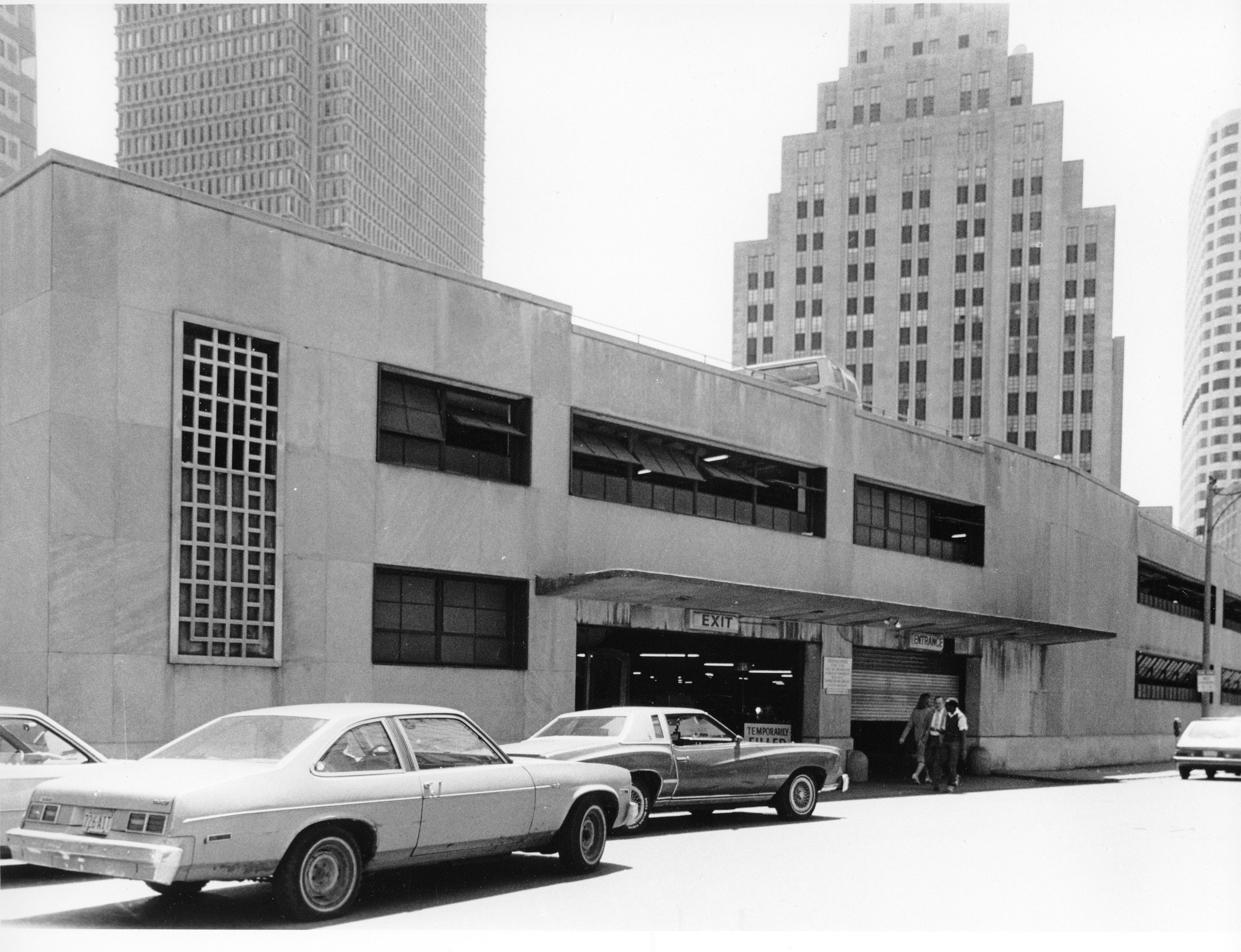
Over the years, DGT and our legacy organizations have worked on the many of the projects in the vicinity, above and below the ground. For example, the center of Post Office Square was once dominated by an ugly garage as recently as the early ’80s, but today it is once again a beautiful park with the garage space buried underground.
The transformation continues in Post Office Square, with new towers replacing older low-efficiency structures. Where buildings aren’t being replaced, there is also a trend to rehab existing structures to reduce cost. A prime example is 1 Post Office Square, a 40-floor tower built in 1981. The 12th-tallest building in Boston, it’s currently undergoing a facelift – a complex task amid the area’s narrow, busy streets. DGT is providing underground and building mapping for the project.
Going Low to Go High
 This type of work is often referred to as a “vertical project,” and involves going high above the ground, as well as deep below it. The first step on this project was to study the history of the streets and buildings. In 1872, the largest fire in the history of Boston destroyed many of the structures in the Financial District, including streets and subsurface facilities like water and gas systems. The rebuilding effort after the disaster led to the construction of many new facilities. New England Telephone and Telegraph built a new control center with numerous vaults and chambers that extended out under the sidewalks and into the streets. Large and complex water, gas, and electrical systems were also installed, making the streets completely congested.
Our first site survey was meant to verify subsurface utility plans and mitigate the conflict between foundation elements and the below-ground networks. Typically, land surveyors compile the records from underground asset owners and correlate the information with surface utility fixtures. While this is an acceptable best practice in many areas, in a congested historical urban area like the Financial District where subsurface foundation elements often encroach into the public street, a simple cross-reference does not provide the critical three-dimensional details needed for final design.
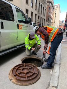
To achieve a higher level of confidence, DGT located and mapped the underground facilities using remote sensing technologies, and entering and mapping the underground spaces. Building a highly detailed digital 3D model, we were able to provide a visualization for the clashes between proposed design elements and the underground facilities. Subsequent non-destructive vacuum excavation services provided an added level of safety in excavation and construction in the congested footprint.
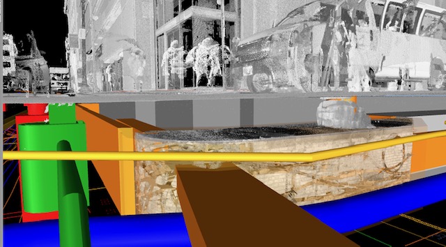
Using LiDAR technologies in unison with subsurface utility mapping is a specialty of ours for complex and convoluted underground environments. We are honored to apply those skills to a project that marks the latest evolution of a historic section of the city that has been reshaping itself for centuries. As the Financial District continues to build on its past, we’ll continue to provide the expert support necessary to keep the vibrancy of Boston’s central business district.