

Hospitals, Colleges, and Universities
Supporting Safer, Smarter Campus Improvement Projects
From utility mapping and surveying to engineering and construction support, we give hospitals, colleges, and universities the expertise they need to keep campus projects on time, on budget, and disruption-free.
Trusted Experience Navigating the Complexity of Campus Infrastructure
The campuses that drive our communities forward, healing patients, educating students, advancing research, are also some of the most complex built environments to improve and maintain. Decades of construction, renovation, and expansion have left most campuses with utility networks that were never comprehensively documented and records that are incomplete, inconsistent, or simply no longer accurate. With continuous operations on these campuses, there is little tolerance for the disruptions that incomplete underground data tends to produce, meaning infrastructure improvements have to be planned and executed with extraordinary care.
The consequences of working from incomplete underground data on a campus are significant. Utility strikes disrupt operations, damage equipment, and put people at risk. Design assumptions built on inaccurate records lead to costly changes in the field. And without a reliable, comprehensive record of what’s underground, every new project starts from scratch, pulling from fragmented sources, making informed guesses, and accepting more risk than necessary.
DGT brings together subsurface utility mapping, including digital utility atlas creation, surveying, engineering, and construction support giving facility managers, owners, and project teams the accurate, accessible information and on-the-ground expertise to plan smarter, build safer, and protect what matters most.

Surveying
High-resolution survey data establishes the baseline for informed engineering and design decisions.
- Existing Conditions Surveys
- Topographic Mapping
- Flood Zone Surveys
- As-Built Surveys
- Construction Layout
- Deformation Monitoring Surveys
- Earthwork Volume Surveys
- 3D Laser Scanning (Ground-Based LiDAR)
- Site Documentation 2D CAD Drawings

SUE/SUM
Complex campus infrastructure projects demand verified insight below the surface. Our utility mapping services align with CI/ASCE 38-22 standards, helping reduce uncertainty in underground construction and prevent costly utility conflicts.
- Subsurface Utility Engineering & Mapping to CI/ASCE 38-22 Standard
- Digital Utility Atlas
- Compilation & Analysis of Subsurface Utility Records
- Remote Sensing Technologies for Subsurface Investigation
- Mobile Mapping Ground-Penetrating Radar (GPR) Surveys
- Electro-Magnetic Line Detection & Tracing
- Utility Mapping in BIM/Revit & 2D/3D CAD
- GIS Integration
Engineering
DGT’s civil engineering team guides projects from initial site assessment and design through permitting and inspection, bringing the technical depth and regulatory know-how to move projects forward with confidence.
- Site Plan Review, Special Permit & ZBA Permitting
- Support for MESA & MEPA Filings
- Stormwater Management Analysis & Design
- Watershed/Hydrologic Stormwater & Flood Modeling
- Hydraulic Analysis & Drainage System Design
- Sewer Connection Plans
- Water Connection Plans
- Site Utilities Layout & Design (Water, Sewer, Drain)
- Vehicular & Pedestrian Pavement Layout & Design
- Erosion & Sediment Control Layout & Design
- Construction Specifications
- Collaboration with Project Design Team Consultants
- Storm Water Pollution Prevention Plan (SWPPP) Filings with EPA
- Curb Cut & Driveway Permits
- Sewage Disposal System Design
- Peer Review, Professional Review & Consulting
- Expert Witness Review & Testimony
Construction Support
Every decision on a construction site has a ripple effect. Our team has the field expertise, surveying detail, and quality control to keep projects accurate, coordinated, and on track from start to finish.
- As-Built Surveys
- Building and Site Work Control
- Construction Layout
- Deformation Monitoring Surveys
- Earthwork Volume Surveys
- Floor Flatness Surveys
- High-Rise Control
- Settlement Levels
What is a Digital Utility Atlas?
Beneath every campus lies a dense, interconnected network of utilities that keeps the institution functioning. Disrupting those systems, even briefly, can have serious consequences. A digital utility atlas provides a comprehensive map of the above and below-ground environment, giving facility managers and contractors a single, reliable source of truth that supports smarter planning, safer execution, and seamless knowledge transfer as teams and contractors change over time.
Built for Knowledge Continuity & Succession Planning
Improved Efficiency for Facility Departments
Accurate Underground Data to the Same Level of Accuracy as the Above-Ground Built Environment
Enhanced Communication Across Departments & Contractors
Heightened Safety for People & Operations
Realized Cost Savings Related to Utility & Underground Risks
Understanding CI/ASCE 38-22 Quality Levels
DGT’s utility mapping services span all four CI/ASCE 38-22 Quality Levels to match project type and budget.
CI/ASCE 38-22 Quality Level D
Research and compilation of proprietary and public utility records to understand site history and existing documentation. Ideal for early-stage planning with lower financial investment.
CI/ASCE 38-22 Quality Level C
Surface-visible utility features are surveyed and correlated with existing records to improve mapping accuracy.
CI/ASCE 38-22 Quality Level B
Buried utilities are detected and mapped using appropriate geophysical technologies. Data is collected by mapping professionals and delivered in CAD or GIS platforms for design integration.
CI/ASCE 38-22 Quality Level A
The highest level of certainty. Using data from vacuum excavation, DGT captures and documents the results to confirm horizontal and vertical utility location, along with pipe size, depth, material, and condition. This level significantly reduces construction risk and utility strikes.
Advanced Technology That Minimizes Risk and Disruption
DGT is one of the only nationwide geospatial firms that owns and operates advanced remote sensing technologies, enabling our team to capture large project areas daily.
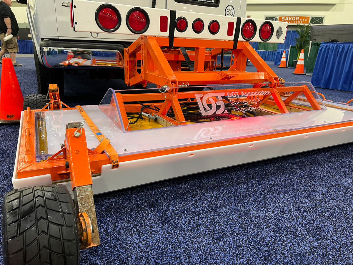
Remote Sensing Technology and Mobile Mapping
Minimizes disruption to pedestrian and vehicular traffic and eliminates the need for police detailing while extracting high-definition images of the underground. Our technology includes pushcart GPR systems, mobile mapping GPR, EMI (traditional pipe locators), and more.
Radar Tomography
Wide array, multifrequency, high-speed data acquisition technology that provides an extra level of care and detail.

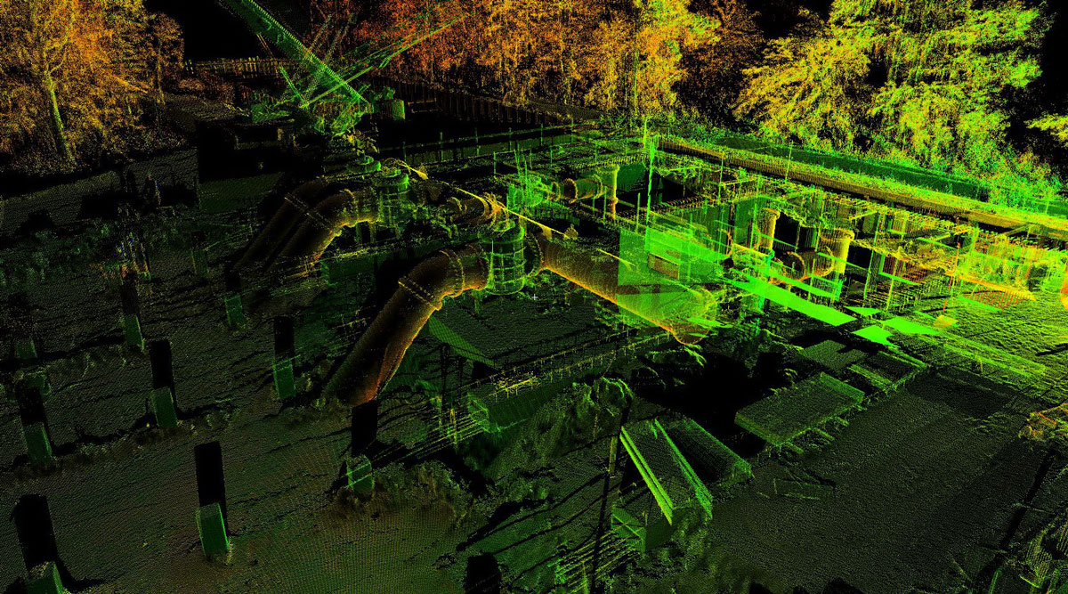
3D Imaging and LiDAR Systems
3D scanners capture a 360-degree picture of the above-ground environment to provide context for underground mapping and allow modeling of existing facilities.
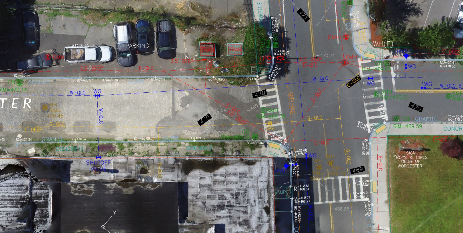
Aerial Imagery
DGT combines imagery with our utility mapping to add perspective and ‘ease of use’ for our clients.
Project Spotlight
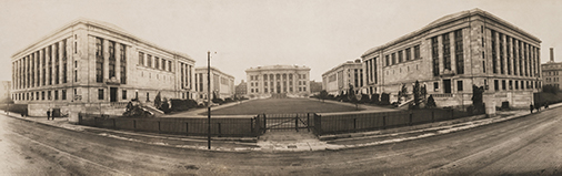
Modernizing an Historic Medical Campus in Boston
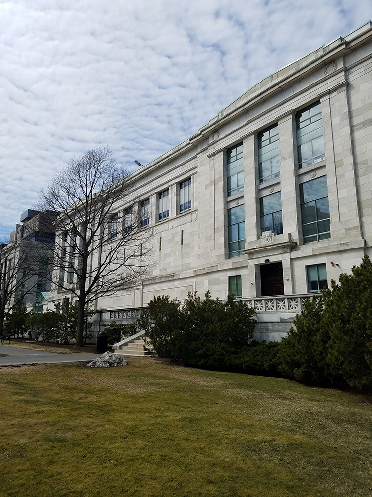
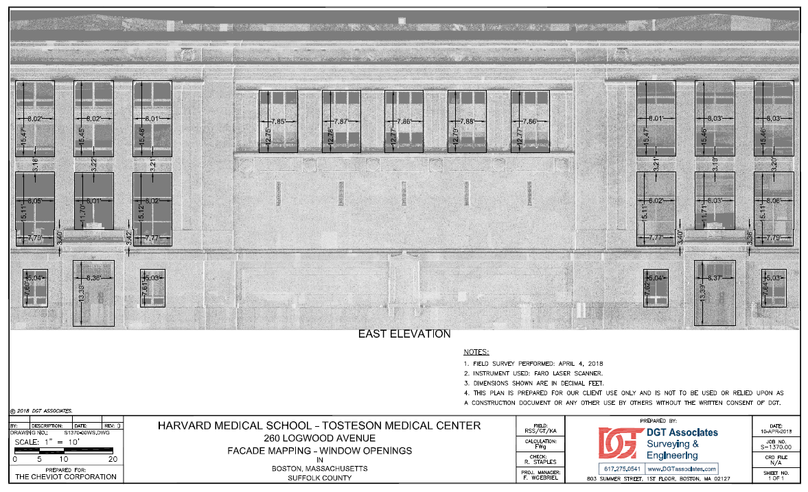
When updated facade maps were needed for the Tosteson Medical Education Center, DGT brought something no other firm could: original campus survey documentation dating back to the early 1900s, preserved in our legacy file archives.
The Tosteson Medical Education Center is an early 20th-century building originally opened in 1906, which anchors Harvard Medical School’s historic Longwood Avenue Quadrangle. Modernizing a building of this age demands precision that current records alone rarely provide.
Luckily, DGT’s extensive legacy archive included an original 1949 survey of the Longwood Quadrangle, which was conducted by William S. Crocker Engineering, along with records from Gunther Engineering, Cullinan Engineering, and Aspinwall & Lincoln, all predecessor firms absorbed into DGT over the decades. Rather than starting from scratch, the team worked from that survey as a foundation, deploying ground-based LiDAR to capture detailed 3D scans of the building’s exterior and produce updated facade maps with the accuracy the project required.
The updated maps gave Harvard’s design and construction team a verified, georeferenced picture of existing conditions, supporting confident decision-making on facade work and reducing the risk of costly surprises. DGT’s connection to this site now spans more than 75 years—a meaningfully long thread of institutional continuity for a project team to be able to draw on.

Surveying
A. John Lloyd, PLS
As a licensed Professional Land Surveyor in Maine, Massachusetts, Rhode Island, Kentucky, and Tennessee, John has with more than 35 years of industry experience. At DGT, he oversees operations for projects across central and western Massachusetts, with a particular focus on leading 3D scanning initiatives.
John represents the surveying profession nationally as a member of the Board of Directors for the National Society of Professional Surveyors (NSPS). He is also the current Chairman of the Scholarship and Program Committee for the Maine Society of Land Surveyors (MSLS), where he previously served as President from 2005 to 2007.

SUE/SUM
Michael A. Twohig
Lead by Michael A. Twohig, Director of Subsurface Utility Mapping and globally recognized SUM expert, DGT Associates understands the complex impact of underground environments on campus master planning and improvement projects.
Michael brings more than 40 years of global experience in professional utility locating and mapping, underground damage prevention, industry safety awareness program, and passion for educating colleagues in the industry to every project he leads.

Engineering and Construction Support
Bert E. Corey, PE
As a licensed Professional Engineer, Soil Evaluator, and Title 5 System Inspector in Massachusetts, Bert brings more than 20 years of experience to his role as Engineering Department Manager at DGT. He oversees civil engineering site planning, roadway design, stormwater management, and sewage system design across commercial, industrial, residential, and municipal projects of all scales.
Bert holds a B.S. in Civil Engineering from UMass Lowell and an M.S. in Environmental Engineering from Worcester Polytechnic Institute.