

LiDAR News Webinar Recap: How DGT Applies 3D Scanning to Real-World Challenges
LiDAR News Webinar Recap: How DGT Applies 3D Scanning to Real-World Challenges
In a recent webinar with LiDAR News and FARO Insight, DGT Associates’ Bob Staples, Co-Founder and Principal, and Fiseha W’Gebriel, 3D Services Manager, explored the advances of 3D scanning through three DGT projects spanning historic restoration, monument fabrication, and structural monitoring. Together, the projects demonstrated how 3D scanning, combined with conventional surveying, can address complex measurement challenges and provide the accurate, detailed data needed to develop CAD, BIM, survey, and digital twin deliverables.
Documenting the New York State Capitol Roof Restoration
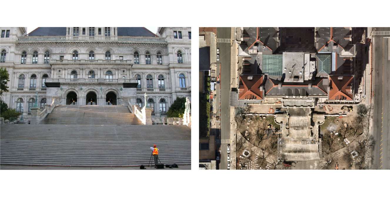
In 2009, the New York State Capitol in Albany was undergoing a multiphase restoration of its historic roof. The project involved rehabilitating the roof’s architectural features, including the signature terracotta elements lining the building’s four towers.
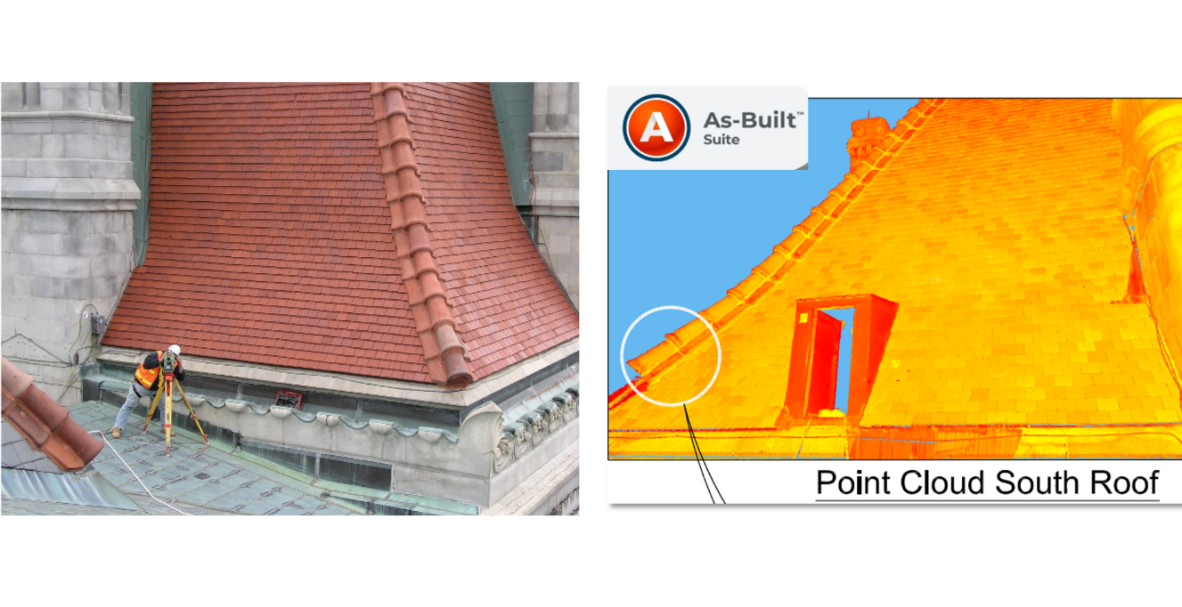
Contractors needed detailed as-built documentation, but the building’s steep roof slopes, complex geometry, and considerable height made it difficult to obtain precise measurements using conventional surveying methods alone. To address these constraints, DGT combined 3D laser scanning with traditional surveying techniques, using a FARO Photon laser scanner to capture more than 90 scans from the roof, ground, and an adjacent building. Survey control provided a common reference framework for aligning the scans, helping the team achieve its target of 10-millimeter overall scan registration error.
DGT then used the captured data to develop as-built drawings documenting the dimensions, angles, and positions of the terracotta elements. With this information available before removal, contractors had a reliable reference for accurately reassembling the historic roof features during restoration.
Recreating Plymouth Rock Through 3D Scanning
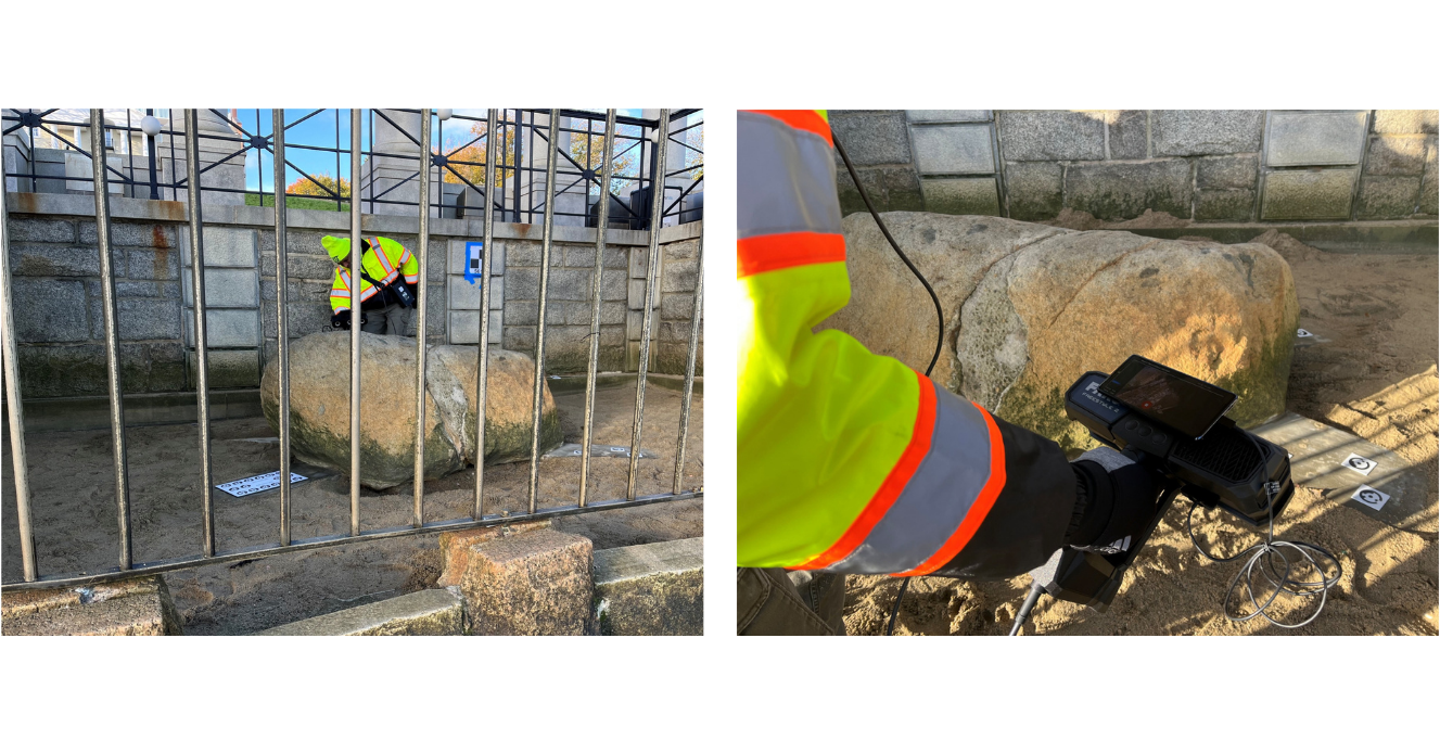
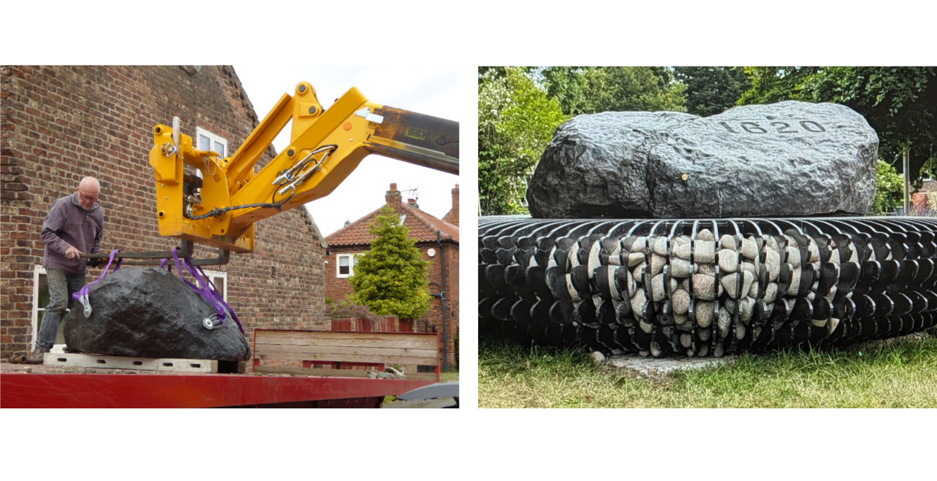
In 2022, DGT received a request from the Scrooby Parish Council in England to help create a commemorative monument honoring the village’s connection to the Mayflower’s historic voyage. The council envisioned a full-scale bronze replica of Plymouth Rock, which required an accurate digital model of the original rock in Plymouth, Massachusetts.
For DGT, this project came with a unique logistical constraint: Plymouth Rock is affected by changing tides, leaving only a limited window to capture its exposed surface. To complete the work within that timeframe, DGT used a FARO Freestyle 2 handheld scanner to record the rock’s detailed geometry during low tide. Once the scan was complete, DGT processed the captured data into a 3D point cloud and converted it into a watertight mesh suitable for fabrication, providing the digital template needed to reproduce the landmark at full scale.
The finished replica now stands in Scrooby as a permanent tribute to the village’s place in Mayflower history.
Monitoring Structural Deflection on a Boston Pedestrian Bridge
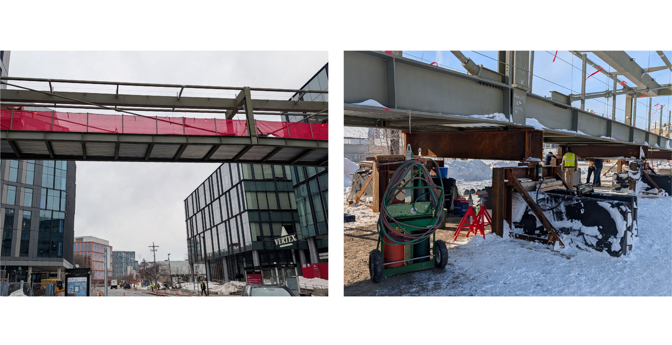
In 2026, DGT supported the installation of a pedestrian bridge connecting two buildings in Boston. Because the bridge was assembled at a separate location before being moved into place, engineers needed to verify how the structure responded as temporary supports were removed and additional loads were introduced. This required monitoring the bridge’s deflection, or the movement and bending that occur under load, throughout key stages of construction.
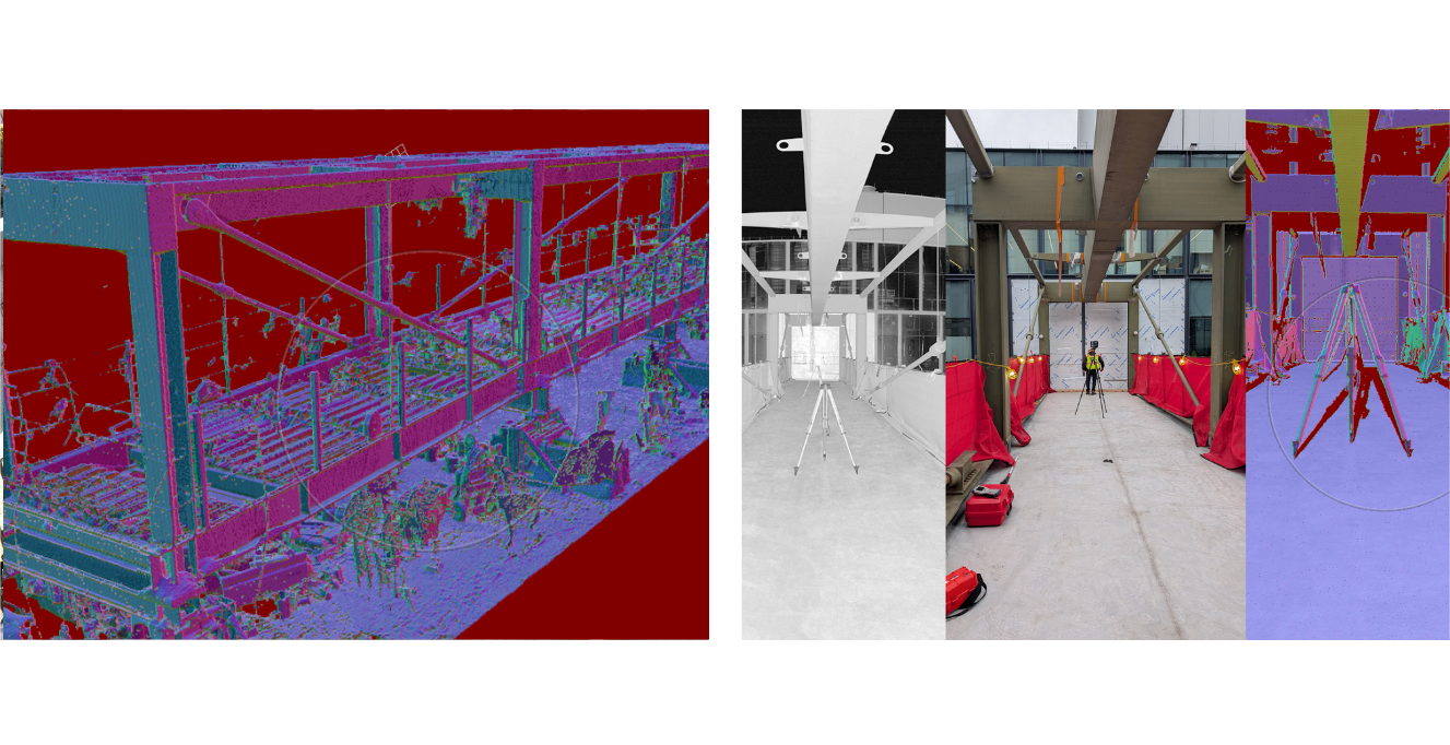
To track these changes, DGT established approximately 46 monitoring points along the bridge. When cold January temperatures prevented adhesive targets from sticking, the team scribed reference marks directly into the steel. At the assembly site, DGT took leveling measurements before and after the bridge’s two middle temporary supports were removed, providing engineers with immediate deflection readings. Laser scanning supplemented these measurements with a detailed 3D record, helping confirm that the movement remained within expected limits.
Once the bridge was installed at its final location, the survey crew measured each monitoring point using a total station, while DGT collected a new baseline scan. Additional measurements were taken after the concrete floor was placed and again following the installation of the curtain walls to assess how the structure responded to increasing loads. DGT compiled the results into a spreadsheet tracking deflection at each monitoring point across the different phases, allowing engineers to verify that the bridge was performing as designed. The bridge is now open and in use.
Beyond the Scan
3D scanning has significantly expanded surveyors’ ability to document complex structures and environments, capturing levels of detail that would be difficult to achieve through conventional measurements alone. As the technology continues to advance, these capabilities are creating new opportunities for project teams to assess existing conditions and address challenges across the built environment.
But capturing the data is only part of the process. Its value lies in translating that information into deliverables that address each project’s specific needs. By combining advanced 3D scanning technology with conventional surveying expertise, DGT transforms complex site data into accurate drawings, 3D models, and monitoring reports that support informed decisions throughout the project lifecycle.
Watch the full webinar and contact our team to learn more about DGT’s 3D scanning capabilities.