The Future of Field Work: 3D Scanning vs. Traditional Surveying—When to Use What
The Future of Field Work: 3D Scanning vs. Traditional Surveying—When to Use What
Surveying has come a long way, and with so many cutting-edge technological advancements, how do we know when it’s time to put down the tripod and pick up the scanner? As industry needs expand and projects grow more complex, surveyors need a broader toolkit at their fingertips. The next era of surveying is defined by speed, accuracy, data-rich insights, and collaboration, but achieving these goals doesn’t mean replacing one method with another. Traditional surveying and 3D scanning aren’t rivals, but complementary tools. The key is knowing which approach best fits each project.
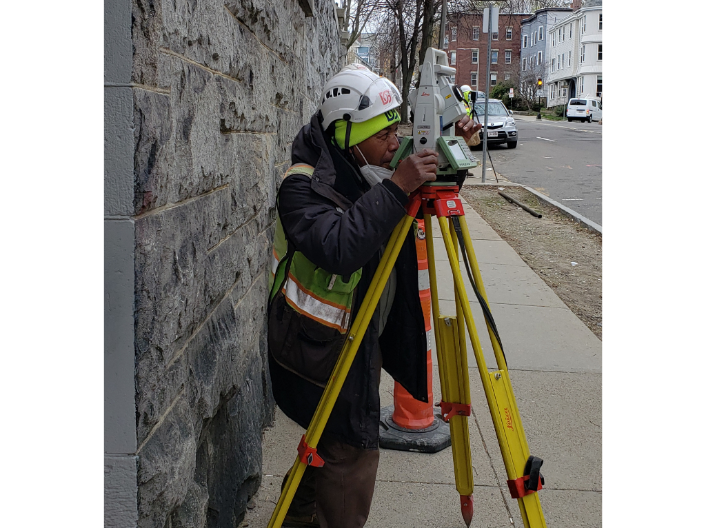
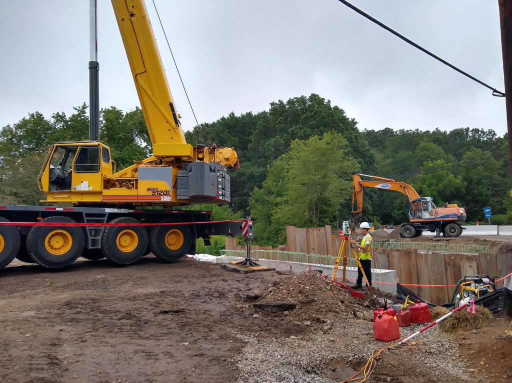
Traditional Surveying: Reliability Through the Ages
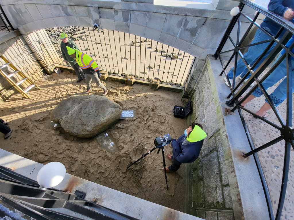
Surveying has a long and storied history, with the earliest documentation dating back to Ancient Egypt around 2700–1400 BCE. Over the centuries, traditional techniques have proven dependable and consistent, standing the test of time. From the trusted tape measure to automatic levels and total stations, there’s a reason traditional survey methods have endured for millennia, continuing to serve as the backbone for the majority of surveying and construction companies today.
Traditional surveying methods are best suited for smaller or straightforward sites, where their simplicity delivers cost-effective results while maintaining excellent point-to-point accuracy. Another key advantage is that these techniques are widely recognized and trusted by courts and regulatory bodies, making them essential for boundary surveys and construction control.
That said, traditional approaches can be time-intensive, often requiring extended work onsite before data can be processed digitally. And because they rely on mostly single point data collection, they capture only select points rather than the full 360-degree environment. For projects that demand enhanced visualization, detailed modeling, or collaboration tools, traditional surveying may not provide all the answers, making it important to consider when newer 3D laser scanning technologies should come into play.
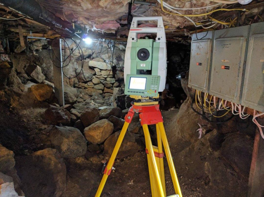
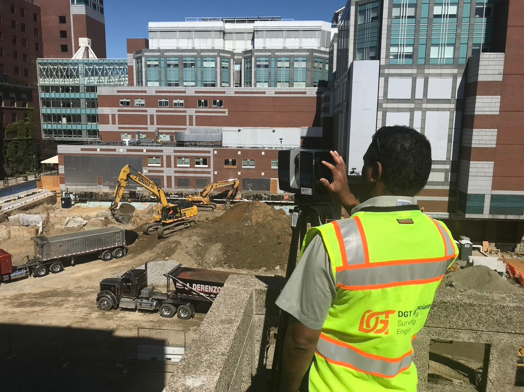
3D Scanning: Capturing Complexity with Detail
First developed in the 1960s for military use and later adopted by private firms in the late 1990s and early 2000s, LiDAR and 3D scanning began to shrink in size and grow in practicality. Still, high equipment costs, the need for powerful computers, and specialized software and skills kept these technologies from becoming mainstream, leaving only a handful of firms able to use them effectively. Today, LIDAR is widely used by surveyors, engineers, architects, and construction professionals who need to capture extensively detailed existing conditions. Other 3D scanning technologies, such as drones, mobile mapping systems, and terrestrial scanners, can also capture millions of data points within minutes, often combining photographic imagery with LiDAR sensors to generate precise 3D models and digital twins.
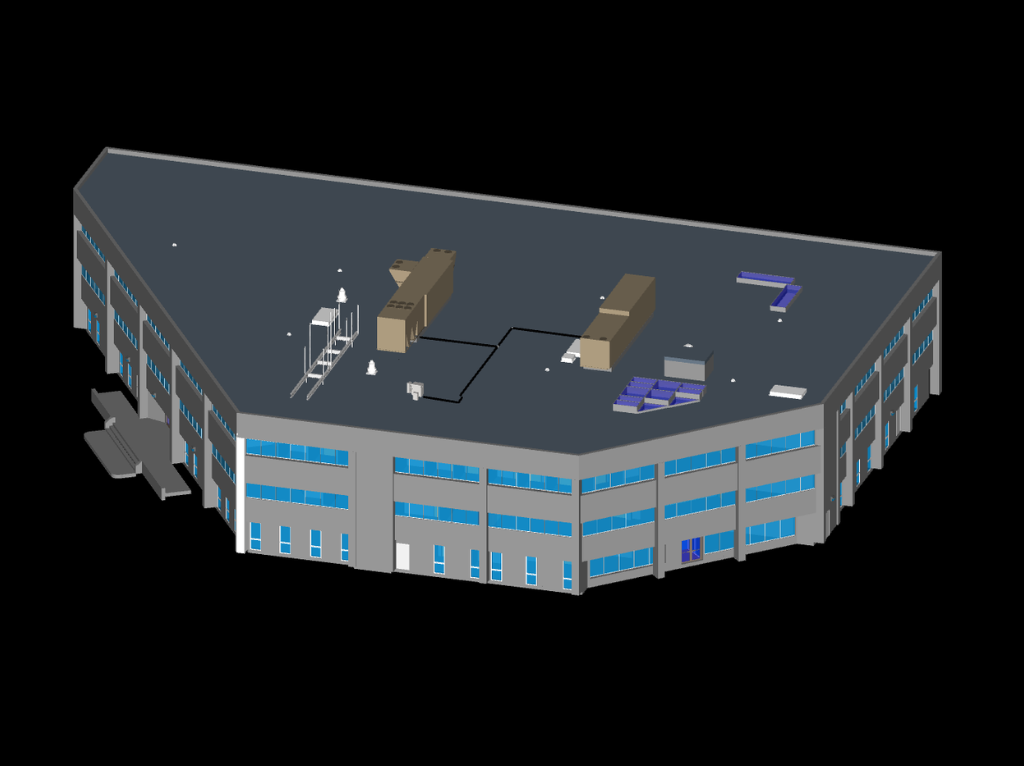
Unlike traditional methods, 3D scanning captures entire environments rapidly and with exceptional accuracy, reducing the time required onsite. The resulting datasets enable advanced outputs such as 3D solid modeling, building modeling, topographic surveys, clash detection, and BIM integration. These capabilities not only support rigorous analysis but also enhance collaboration among architects, engineers, and contractors. The ability to replicate conditions and model scenarios in detail makes 3D scanning particularly well-suited for documenting complex facilities, large-scale infrastructure, or existing built environments.
The benefits, however, come with higher upfront costs. Investment in specialized equipment, software, and skilled professionals is essential, and the management of large datasets requires significant expertise. Also, while 3D scanning reduces time spent in the field compared to traditional techniques, it often requires additional office time to process data and generate dynamic models. As a result, 3D scanning is not always the most cost-effective option for smaller or straightforward projects where simpler data collection is sufficient.
Navigating the Balance Between Tradition and Technology
To optimize project outcomes and resource use while maintaining high standards of accuracy, surveyors should evaluate three key factors when selecting the most strategic approach:
Project Size & Complexity: Traditional methods remain ideal for smaller parcels or straightforward boundary surveys, where simplicity and point-to-point accuracy suffice. In contrast, 3D scanning excels on complex sites, such as hospitals, bridges, industrial plants, or large infrastructure projects, delivering high-density, high-quality data rapidly.
Client Needs & Regulatory Requirements: Legal and regulatory mandates often dictate the use of traditional surveying, making it the preferred choice for boundary or compliance-focused deliverables. While projects that require advanced visualization, modeling, clash detection, or collaborative digital workflows benefit significantly from 3D scanning capabilities utilizing traditional survey control.
Budget & Timeline Considerations: For projects with smaller budgets or simple deliverables, traditional surveying provides a cost-effective, reliable solution. Conversely, 3D scanning offers long-term value when clients are comparing changing site conditions or prioritize rapid data capture, comprehensive datasets, and enhanced analytical or modeling potential.
By carefully considering these factors, surveyors can strategically balance traditional surveying and more modern 3D laser scanning approaches, ensuring both accuracy and efficiency while still delivering maximum value to their clients.
Integrating Classic Methods with Innovation
So, to answer our original question: it’s not a matter of choosing one approach over the other. Integration, not replacement, defines the next generation of surveying. Rather, the real question is not “Which approach is best suited for this project?” Firms that strategically combine traditional and 3D scanning methods capture the benefits of both, delivering projects with greater efficiency and insight.
Recognizing that drones, mobile LiDAR systems, multi-channel GPR, and advancing 3D laser scanning equipment involve significant investment and are constantly evolving, DGT launched a partner program to expand access to these capabilities without unnecessary financial risk. Through these partnerships, firms gain access to advanced technology and specialized expertise for complex or large-scale projects. Collaboration with DGT ensures that clients of all sizes benefit from optimized workflows, safer field operations, and richer, more actionable data.
Leveraging the Best of Both Worlds
Successful field work is about leveraging the strengths of both traditional surveying and 3D scanning. Traditional methods provide compliance, reliability, and point-to-point accuracy, while 3D scanning delivers speed, context, and advanced visualization. By combining seasoned survey expertise, advanced technology, and collaborative networks, DGT ensures clients receive the data and insights needed, regardless of project scale or complexity.
Get in touch to see if our partner program is right for you.