Subsurface Utility Mapping Specialists, Contract Utility Locators, and 811 Practitioners: Three Unique Roles in Utility Detection
Subsurface Utility Mapping Specialists, Contract Utility Locators, and 811 Practitioners: Three Unique Roles in Utility Detection
When it comes to underground utility detection, not all practitioners serve the same purpose. Despite this, many asset owners, planners, and engineers confuse the roles and responsibilities of 811 programs, contract utility locators, and Subsurface Utility Mapping (SUM) professionals, often viewing any practitioner using similar technology as part of the same profession.
To make informed decisions that ensure safe, efficient, and successful projects, it’s important that engineers, contractors, and project planners understand the distinct functions, methods, and deliverables associated with each role.
Understanding the Difference: 811 and Contract Utility Locating Practitioners
Following the national requirement, anyone planning excavation must provide advance notice through the 811 program—or “Call Before You Dig” phone number. This critical service routes callers to local 811 centers that determine the project location using address and geofencing technology, then notify public and private utility owners to dispatch locators. Using available plans, records, and locating devices, 811 responders then mark underground utilities with paint and/or flags to help prevent damage during excavation, primarily on public property. Facility ownership, utility easements, and exemptions can influence how locating and mark-outs occur on private land.
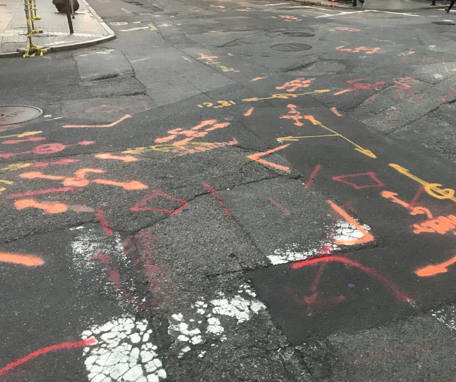
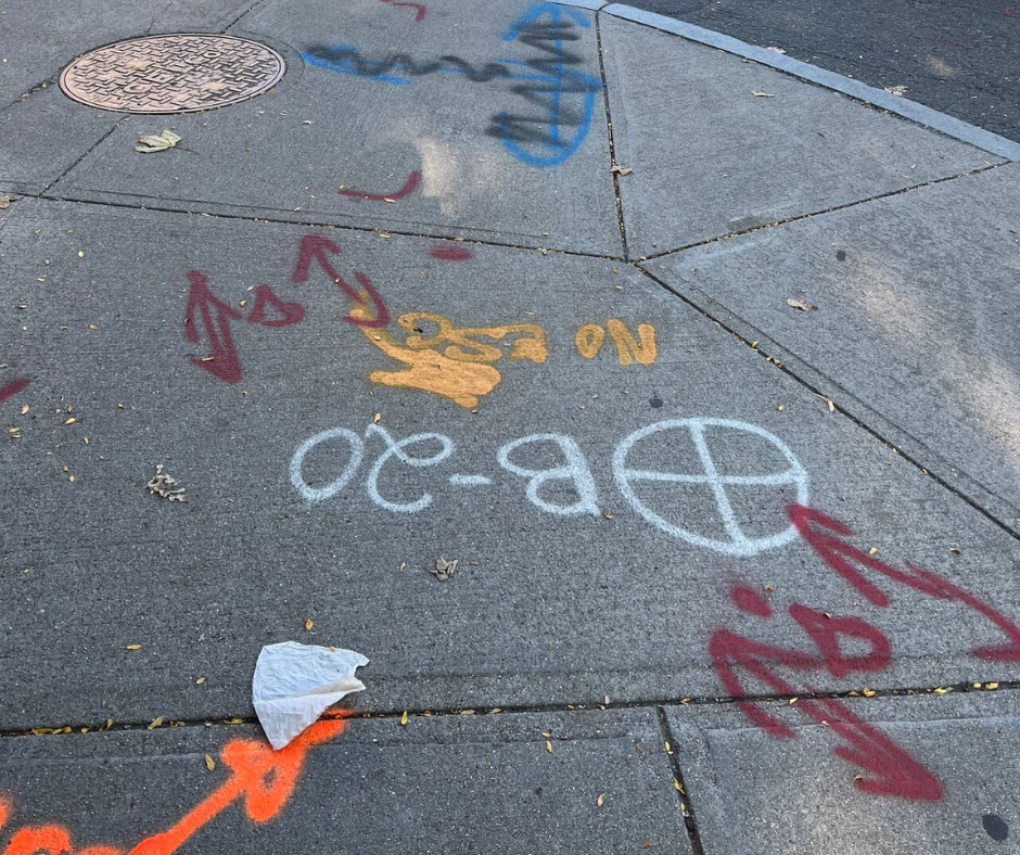
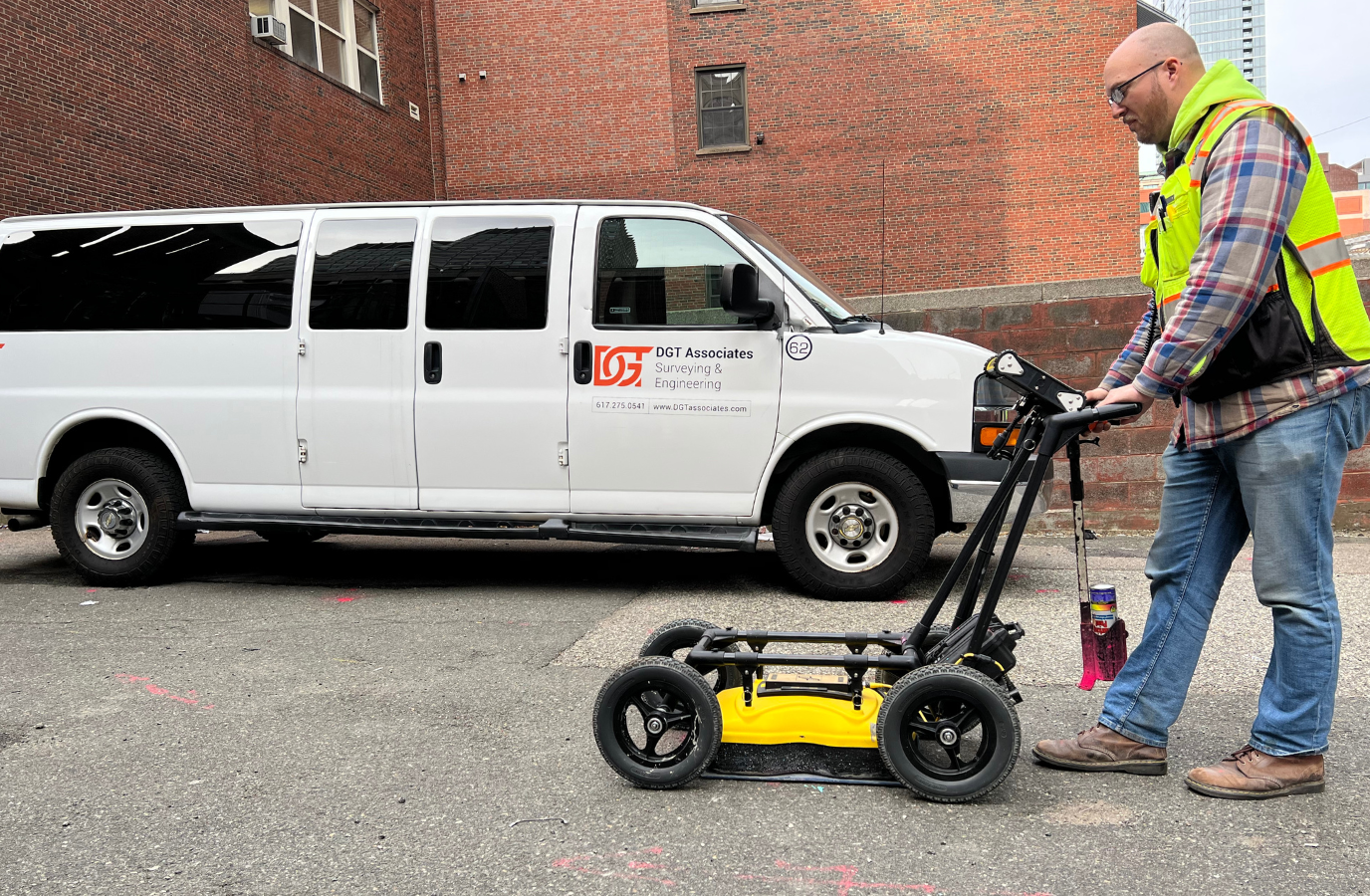
Unlike 811 responders, which fulfill contractors’ obligations to comply with state and federal regulations, contract utility locators are hired on an as-needed basis by private and public clients, and often work beyond public rights-of-way. They trace and mark the approximate locations of underground utilities using the same color-coded paint and flags as 811 responders to help prevent utility strikes. Contract locating requests generally require quick turnaround, and deliverables usually consist of site markings alone, though some firms also document their findings in a brief report.
Building Smarter from the Ground Down: The Case for Early SUM and ASCE 38-22 Compliance
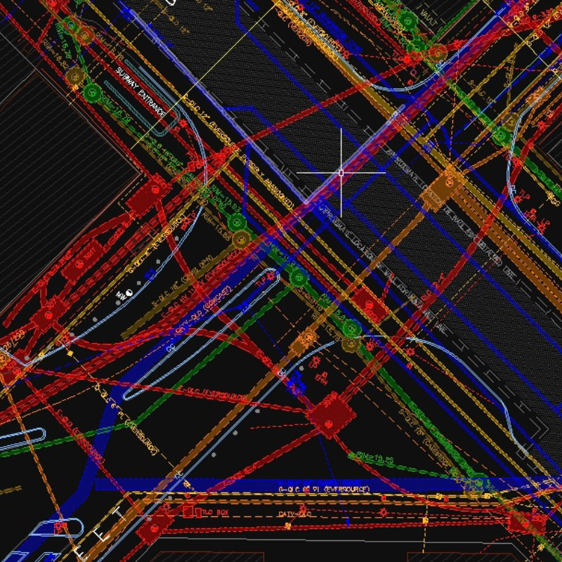
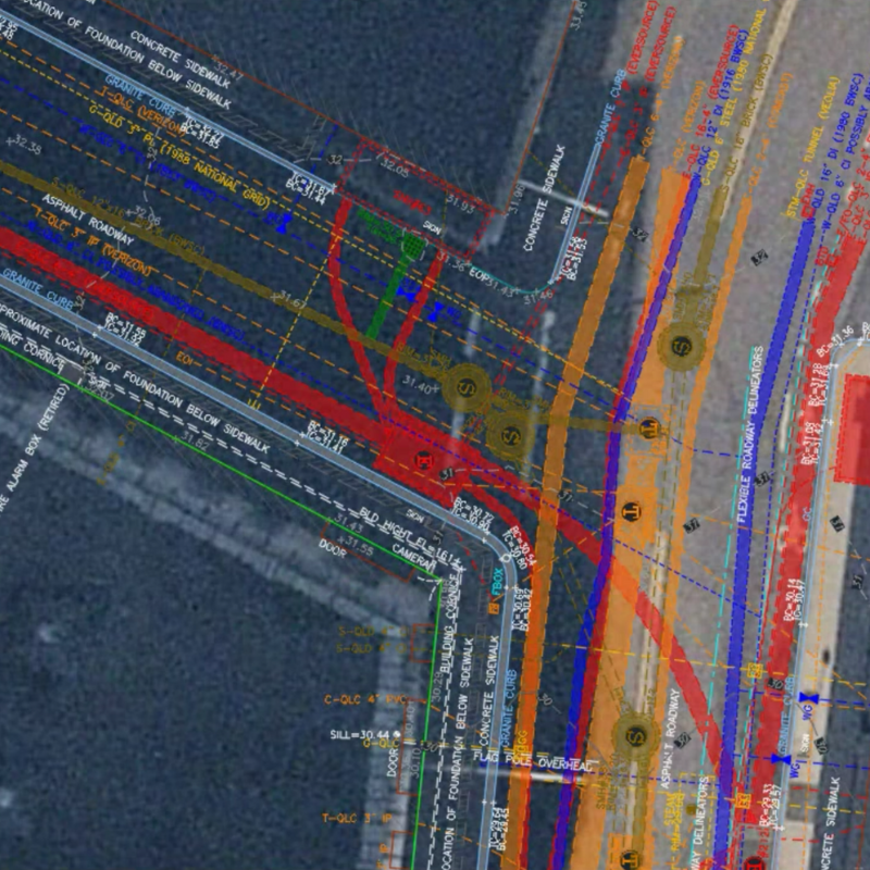
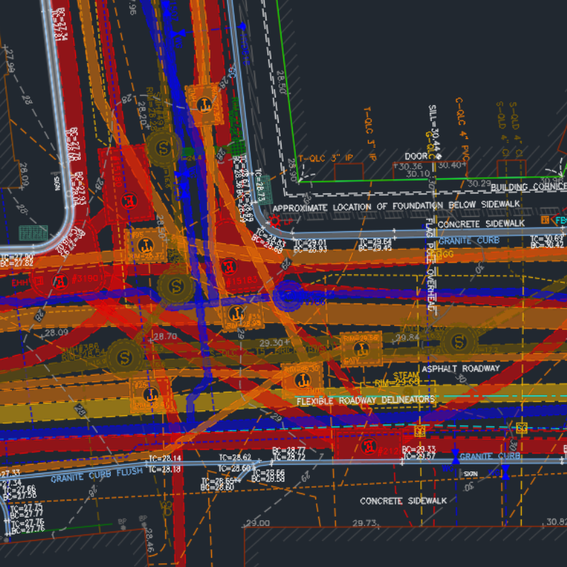
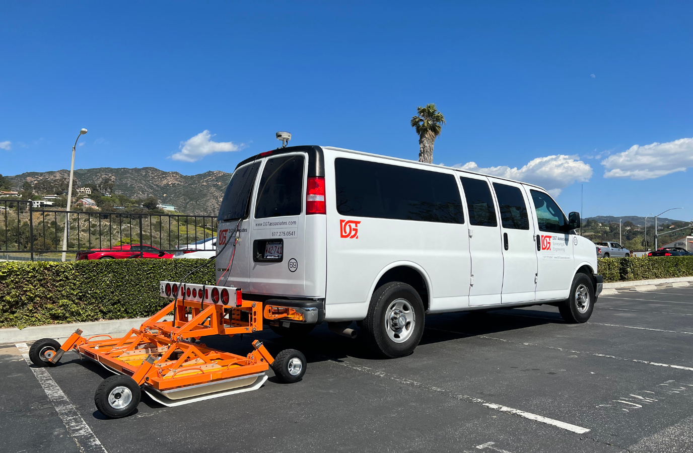
SUM is a specialized discipline dedicated to locating, mapping, and verifying underground utilities early in the project lifecycle. Working with geospatial specialists such as photogrammetrists, land surveyors, drone operators, and lidar experts, SUM professionals deliver a comprehensive, digital existing-conditions survey of above- and below-ground features—helping design teams make informed decisions that help prevent costly surprises, protect infrastructure, and keep the community safe.
A best practice for both large and small projects, SUM is legally required in certain states and municipalities—especially for public works and large-scale construction. States like Pennsylvania and Colorado require utility locating to conform to ASCE 38-22 guidelines, which set the industry standard for mapping and verifying underground utilities.
ASCE 38-22, while not required by law nationwide, is widely referenced by 811 centers and SUM professionals. Likewise, utility mapping contracts and deliverables generally follow ASCE 38-22 guidelines, with digital files annotated to its specifications. This framework enables asset owners, civil designers, and geospatial firms to collaborate effectively on scoping, budgeting, and executing underground utility investigations and better manage the associated costs, timeline, and risks before construction begins.

By identifying and mapping underground utilities early in the design phase, SUM professionals help mitigate costly delays, safety risks, and rework during construction. Their comprehensive project files empower designers to protect underground infrastructure or engage utility owners in advance if relocations are needed. In contrast, temporary site markings from 811 responders or contract locators provide limited value to designers unless they are incorporated digitally into an existing-conditions plan.
Unlike contract locating focused on short-term excavation safety, SUM projects can span weeks, months, or even years. Through detailed data collection, verification, and documentation, SUM delivers accurate, georeferenced utility locations and digital depth information as a matter of standard practice.
Using These Services in Tandem
In today’s fast-paced construction environment, SUM professionals, 811 responders, and contract utility locators each play a vital role in project safety and success. To ensure that project documents reflect site conditions, they must incorporate SUM results, alongside contract locator markings, and 811 mark-outs—meaning collaboration is key. Likewise, utility mapping and contract locating services can help 811 responders optimize the impact of on-site markings.
Together, utility locating and mapping practitioners play an instrumental role in protecting construction teams, safeguarding critical underground infrastructure, and promoting overall project success.
Looking for SUE/SUM expertise on your next project? We’re ready to help.