Enhancing Flood Resilience: Applying Subsurface Utility Mapping to Optimize Sustainable Drainage Implementation
Enhancing Flood Resilience: Applying Subsurface Utility Mapping to Optimize Sustainable Drainage Implementation
As climate change accelerates, effective drainage systems are vital to our infrastructure, safeguarding community health and safety by reducing the impacts of flooding, erosion, and water contamination. Despite its importance, drainage maintenance remains underfunded at both the state and federal levels across the U.S. As a result, the U.S. loses an estimated 2.1 trillion gallons of water annually due to failures in our overwhelmingly aging water infrastructure. Issues like water line breaks can create substantial hazards for communities and businesses, increasing the likelihood of contamination and waterborne illness, causing flooding and property damage, driving up repair costs, and wasting an essential natural resource.
Underground drainage systems manage water from various sources—from rainfall to domestic water—removing it from the surface and transferring it to treatment centers, ensuring contaminated water is properly treated. Effective drainage prevents overflow and leakage, protecting roads, connected sewer systems, and other critical infrastructure. The U.S. underground network of stormwater drainage systems includes an estimated 3.5 million miles of storm sewers and 270 million storm drains, which municipalities are required to map under the NPDES MS4 program. That said, as of 2018, only 40% of stormwater utilities had taken this step, resulting in millions of unmapped utilities.
To improve the resilience of our water drainage systems, civil engineers should look to partner with Subsurface Utility Engineering and Mapping (SUE/SUM) specialists. Subsurface utility investigations can provide insights into surface topography and the underground environment, informing design choices that ensure safe, efficient water flow. It’s critical that firms collaborate to address the growing challenges posed by aging systems that are ill-equipped to manage the increased frequency and intensity of precipitation due to climate change.
The Consequences of Climate Change Induced Flooding
Climate change has intensified flooding events, threatening infrastructural integrity globally. Rising ocean temperatures cause increased evaporation, resulting in moisture-laden air that fuels more frequent storms and heavier rainfall. When precipitation exceeds normal levels, drainage systems can become overwhelmed and incapable of managing the volume of water, leading to flooding.
In the U.S., flood events caused by excessive rainfall result in an average cost of $4.7 billion annually—excluding costs from tropical storms. With approximately 25% of our critical infrastructure, such as police stations, airports, and hospitals, and an estimated 21.8M U.S. homes and businesses at risk of flood damage, there’s a national urgency to improve water system maintenance. Beyond structural damage and extensive repair costs, flooding poses serious risks, including personal harm, such as injury from debris and drowning, long-term health complications due to water and vector-borne diseases, and environmental impacts due to phosphorus runoff from wastewater.
In January of 2024, San Diego experienced heavy rainfall, totaling three inches in three hours, which quickly overwhelmed drainage systems and led to severe flooding. Within hours, the San Diego Fire Department had conducted nearly 200 swift water rescues. After the storm, city officials estimated $7 million worth of infrastructural damage, including around 1,000 homes and businesses. The impact of one extreme weather event has caused the community to suffer immensely, and efforts to repair damage are ongoing even nine months later.
Aging drainage systems have further exacerbated flooding, as they are incapable of accommodating today’s increased rainfall. With adequate resources, cities and commonwealths can upgrade infrastructure to improve flood resilience. Using SUE/SUM to support updates and implementation, as well as expanding drainage pipes, tanks, and catch basins, can strengthen systems to manage higher water volumes. For example, in Somerville, MA, a sustainable drainage overhaul is underway, beginning with the construction of a 14-foot-wide drainage culvert that runs beneath Somerville Ave. This new pipe provides more effective stormwater management by allowing water to flow freely under the busy streets without obstacles. Additionally, a four-million-gallon stormwater storage tank will be installed to handle heavy rain flow and prevent stormwater overflow.
The Role of SUE/SUM in Enhancing and Replacing Drainage Systems
While surveying has long supported FEMA and government agencies in mapping impacted above-ground areas before and after storms, understanding the below-ground infrastructure is more challenging. Surveying in this traditional context is valuable but often serves as a reactive, post-storm response. By contrast, SUE/SUM offers a proactive approach, leveraging advanced surveying technology to reveal critical subsurface insights that drainage engineers can use to develop more sustainable systems. For example, drainage engineers can leverage topographic survey maps to determine the elevation at which drainage systems are place to enhance water flow.
Additionally, SUM is critical in providing drainage engineers with visibility into the underground environment prior to implementation—ensuring new systems do not conflict with existing utilities. Unlike water pipes, drainage and sewer systems cannot be easily moved once installed. Therefore, it’s imperative they’re designed with an accurate understanding of the subsurface environment and placed in the proper location during installation.
For any project breaking ground, underground mapping provides designers, engineers, and project owners with the subsurface knowledge necessary to mitigate striking or damaging utilities and, in turn, protect construction crews and communities, maintain project timelines, and ultimately prevent budget overruns. Beyond a single project, SUM records also function as a single source of truth for decades to come.
SUM Insights in Action: Fall River, MA Project Spotlight
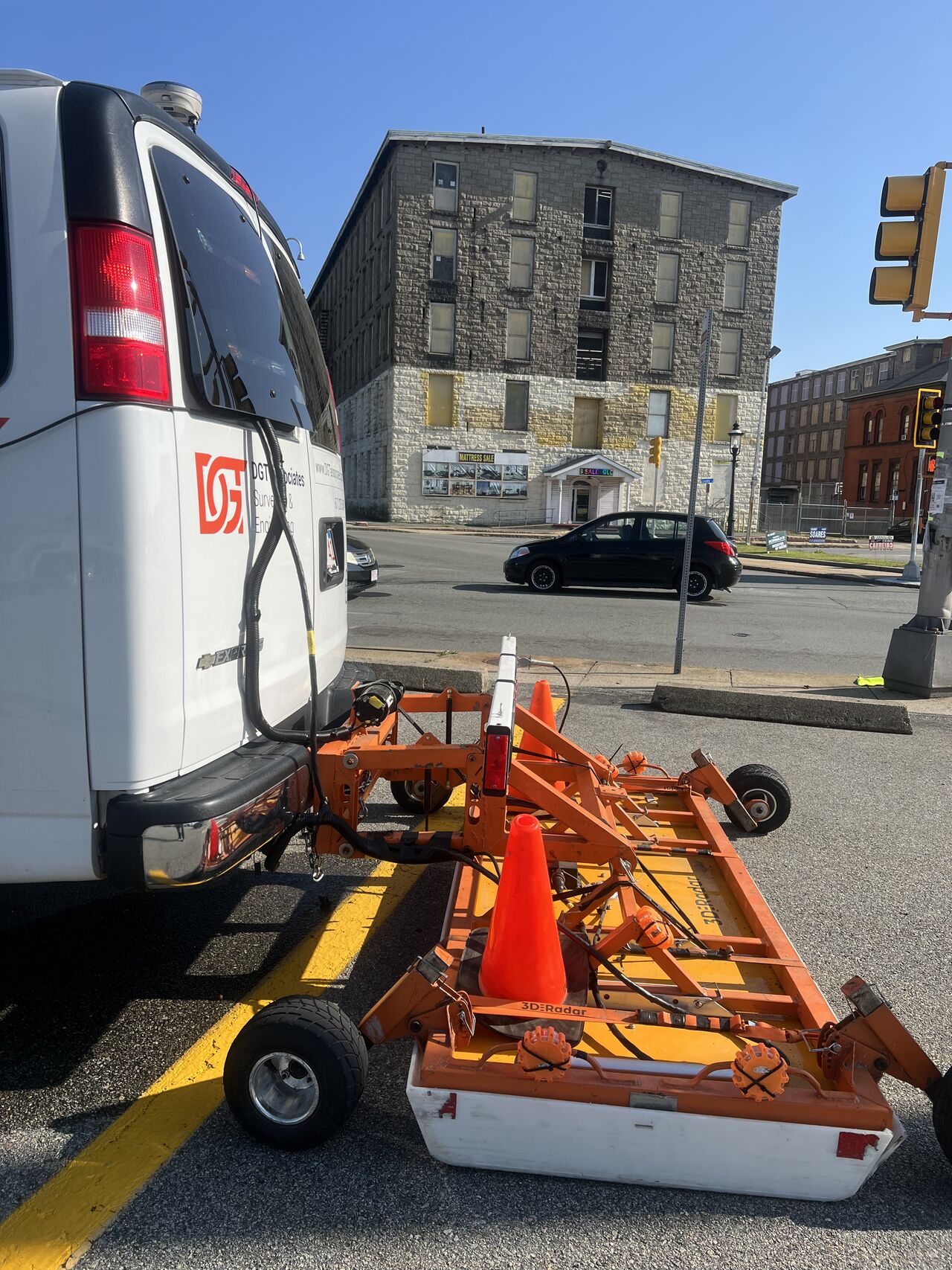
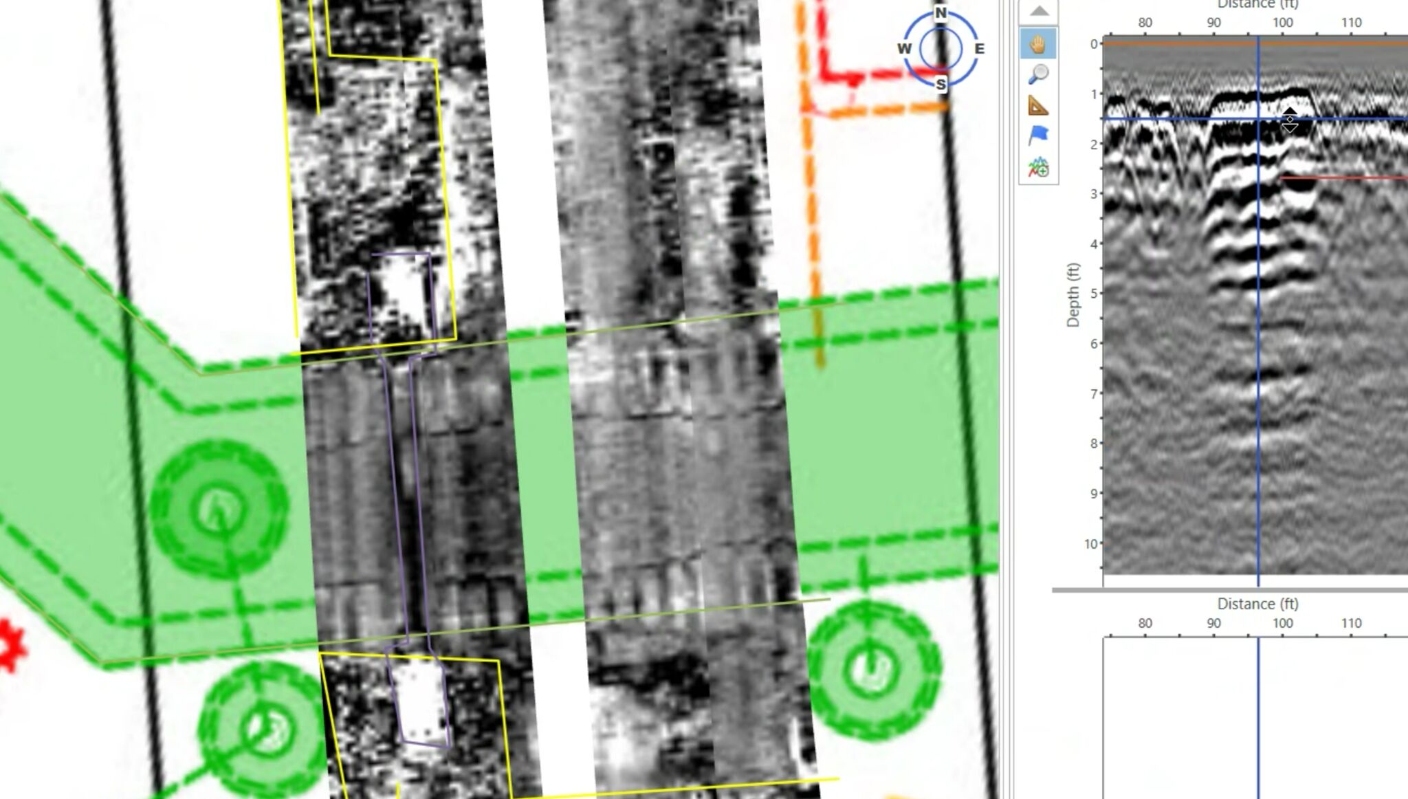
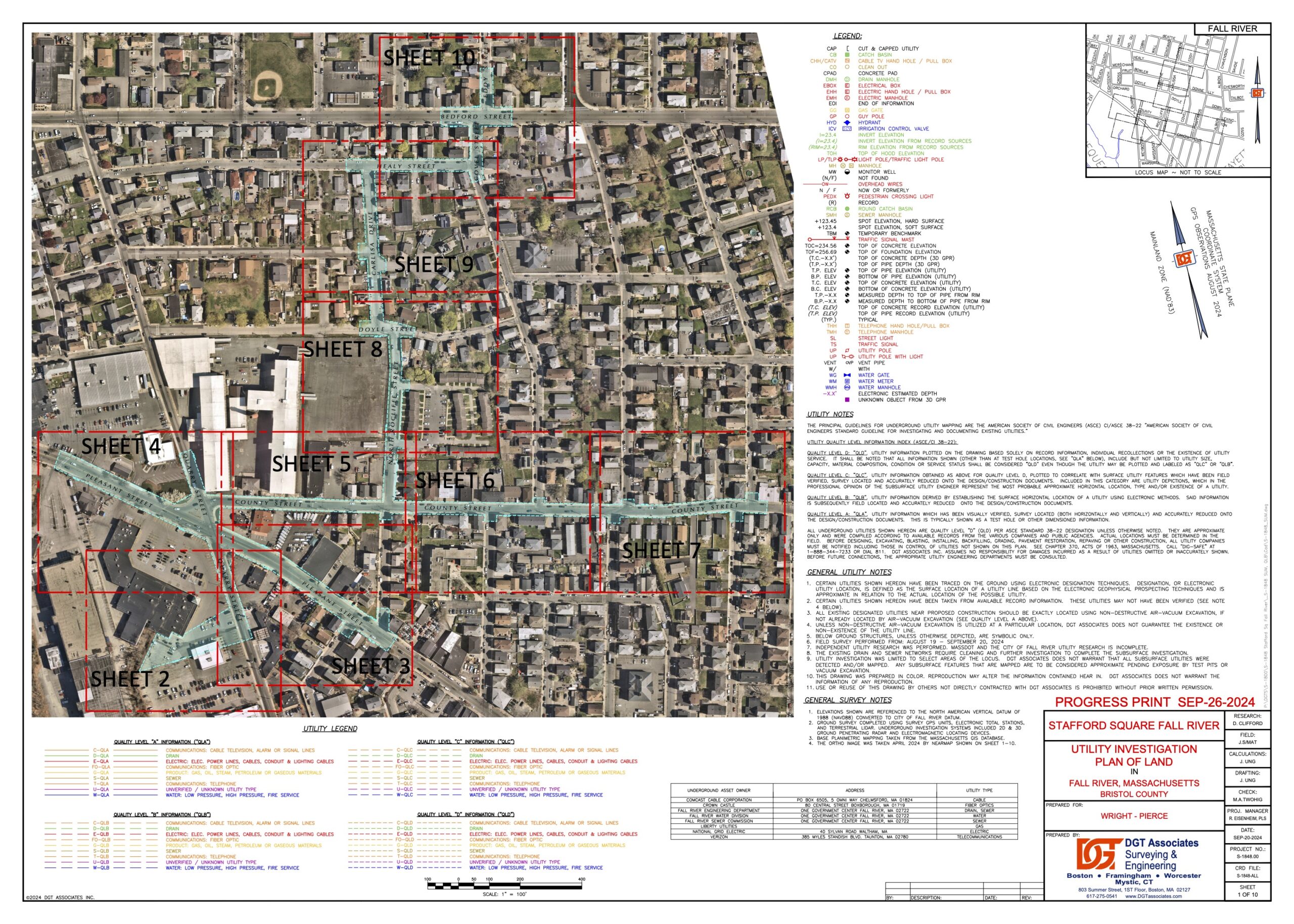
This year, the DGT team played a pivotal role in addressing severe flooding in Stafford Square in Fall River, MA—an area increasingly impacted by climate change. To support the replacement of aging drainage infrastructure, we provided essential surveying services using total stations, mobile mapping, and ground-penetrating radar (GPR). Our investigations provided us with the data needed to create a detailed topographic utility map, complete with datum and autoCAD, which revealed an array of underground obstacles, including abandoned utilities and historic streetcar tracks. These critical insights gave designers and engineers a comprehensive view of both the surface and subsurface environments, empowering them to develop more strategic, effective project plans.
Combatting Flood Risks Through SUE/SUM and Engineer Collaboration
Flooding is a serious issue that impacts more areas of the country each year as climate change intensifies. However, we can reduce the effects of extreme precipitation by modernizing outdated and inadequate drainage systems. For these projects, drainage engineers should collaborate closely with SUM professionals throughout the project’s design and implementation phases. By integrating SUM expertise, engineers can gain critical insights into subsurface conditions, increasing design accuracy, minimizing utility conflicts, and creating safer, more sustainable communities.


